


The Largest Construction and Land Surveying Technology Supplier in the Northwest.
Showing 1–12 of 13 results
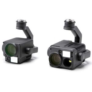
“H” For Hybrid
Multi-sensor payloads that bring a whole new meaning to mission efficiency. The unique intelligence and integrated design provide unprecedented aerial imaging capabilities for a range of commercial drone applications.
Welcome to DJI’s first hybrid sensor solution – the Zenmuse H20 Series.
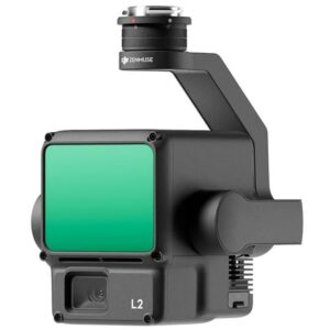
A Lidar + RGB Solution for High-Precision Aerial Surveying
Zenmuse L2 integrates frame LiDAR, a self-developed high-accuracy IMU system, and a 4/3 CMOS RGB mapping camera, providing DJI flight platforms with more precise, efficient, and reliable geospatial data acquisition. When used with DJI Terra, it delivers a turnkey solution for 3D data collection and high-accuracy post-processing.
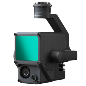
A Lidar + RGB Solution for Aerial Surveying
The Zenmuse L1 integrates a Livox Lidar module, a high-accuracy IMU, and a camera with a 1-inch CMOS on a 3-axis stabilized gimbal. When used with Matrice 300 RTK and DJI Terra, the L1 forms a complete solution that gives you real-time 3D data throughout the day, efficiently capturing the details of complex structures and delivering highly accurate reconstructed models.
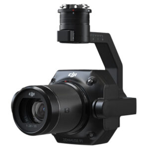
DJI Zenmuse P1
The Zenmuse P1 integrates a full-frame sensor with interchangeable fixed-focus lenses on a 3-axis stabilized gimbal. Designed for photogrammetry flight missions, it takes efficiency and accuracy to a whole new level.
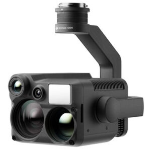
“N” for Night Vision The Zenmuse H20N integrates starlight sensors1 into its zoom and wide-angle cameras. Pair this with dual zoom thermal cameras and a laser rangefinder, and you have a versatile hybrid payload that rises to the occasion.![]()
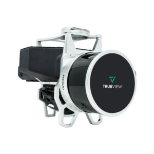
TrueView 435 is the most economical platform for utility-grade mapping. GeoCue’s TrueView 435 is our next generation compact 3D Imaging System that has sensitivity needed for infrastructure mapping. In addition, its superior ground capturing capabilities for lightly vegetated areas make this the most economical platform for utility grade-mapping.![]()
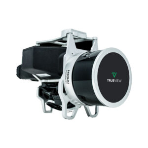
GeoCue’s TrueView 515 is simply the best performing LIDAR/Camera system in the mid price range. This compact 3D Imaging System has impeccable definition along wires, superior ground cover beneath vegetation and sensitivity like we’ve never seen in this class system.
![]()
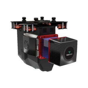
The TrueView® 655/660 is GeoCue’s third generation RIEGL integration built with the miniVUX-3UAV and triple mapping cameras (right, left, nadir) for high accuracy mapping with excellent vegetation penetration and wire detection in a lightweight payload package.
![]()
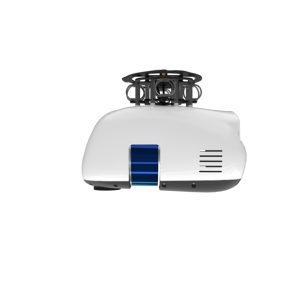
This is Microdrones best LiDAR drone surveying equipment ever. Built upon their 4th-gen drone technology, all MicroDrone EasyOne systems are more compact, more optimized, lighter, safer and more efficient.
![]()
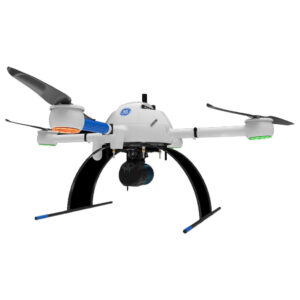
The mdLiDAR1000UHR can help streamline your current workflow to become more efficient, while helping you to complete more projects.
![]()
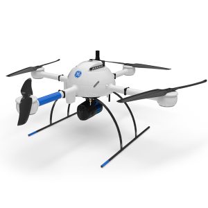
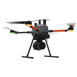
GE Industrial Drone Line – Proven industry leading drone lidar survey equipment and software. mdLiDAR1000HR: HR means high resolution pointclouds and increased coverage is made easier and more accessible than ever.
Microdrones
![]()
21601 66th Ave. West, Unit A
Mountlake Terrace, WA 98043
United States
Toll Free: 800-454-1310