


Description
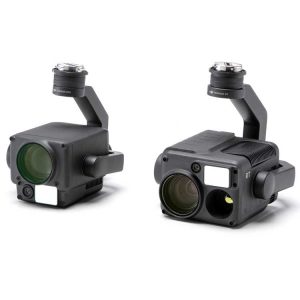
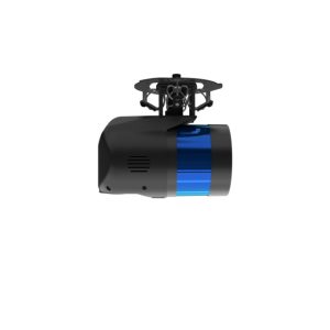
Microdrone EasyOne LidarUHR Series
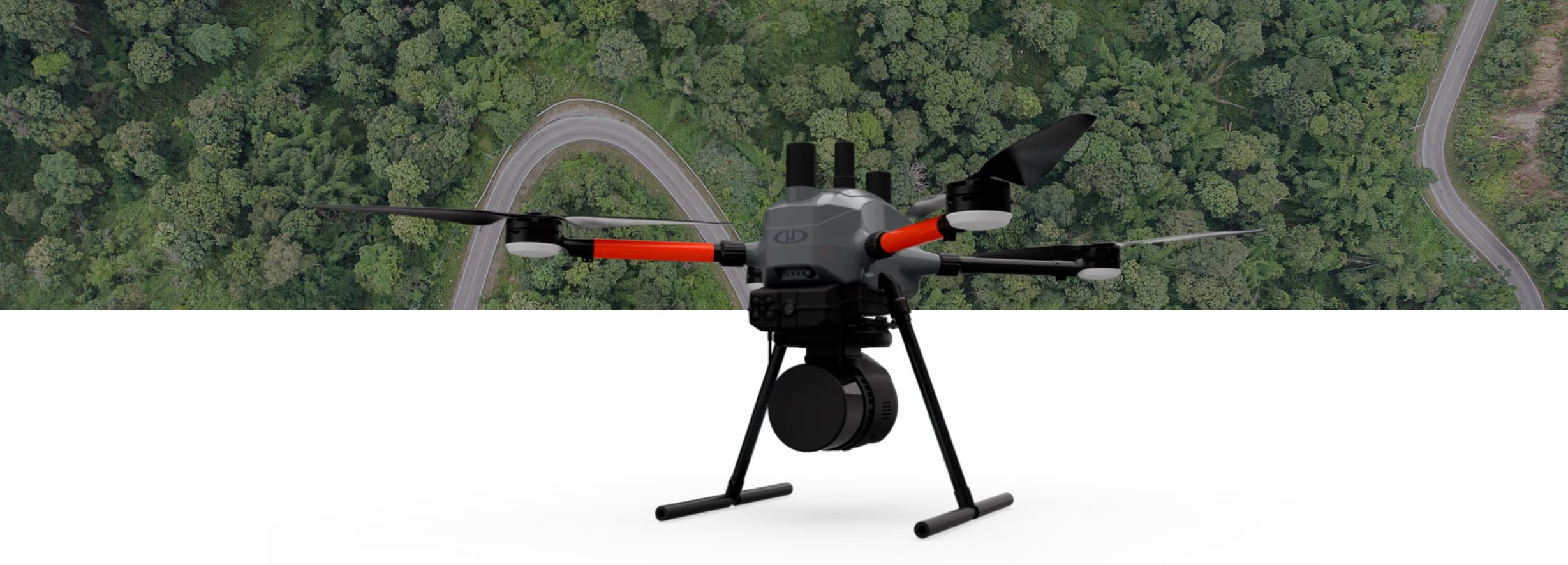
THE MOST COMPACT SURVEY-GRADE DRONE LiDAR SURVEYING EQUIPMENT ON THE MARKET: EasyOneLiDARUHR+
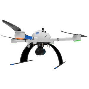
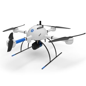
SMALLER, SAFER AND EASY TO USE
This is Microdrones best LiDAR drone surveying equipment ever. Built upon their 4th-gen drone technology, all EasyOne systems are more compact, more optimized, lighter, safer and more efficient. This system delivers integration unmatched in the drone surveying industry, making it easier than ever for you to plan, fly, collect, process and visualize your geospatial data projects.
EASYONE IS ALL IN ONE.
The improved controller is completely integrated with mdCockpit. No more connecting a tablet to your remote!
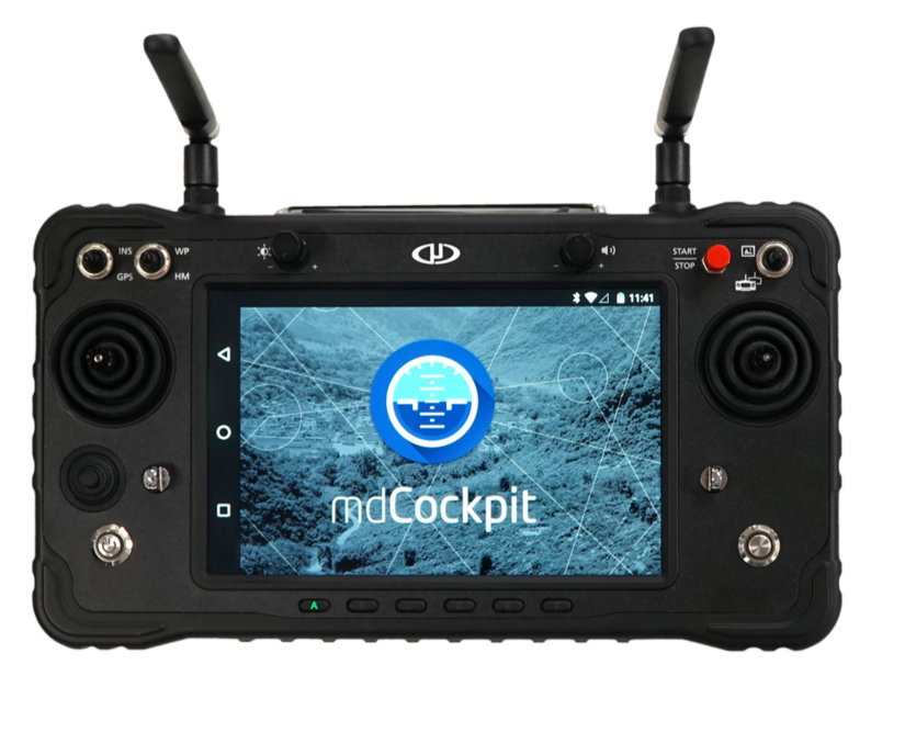
NEW! First person view in flight video display
EasyOne features an entirely new controller design that provides an enhanced user interface and powerful safety features, such as Real Time Terrain Follow.
Combined device and integrated remote control- the RC and display are one integrated control unit.
mdCockpit is integrated directly on your RC screen!
FPV available directly on the remote
Ask us about NDAA compliant version.
High level command of the drone without using the sticks on the remote
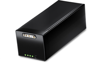
A NEW BATTERY MANAGEMENT SYSTEM FOR SMART SURVEY AND GEOSPATIAL PROS:
EasyOne includes a new Battery Management System that enables easy charging. Via a single connector, plug it in, and charging starts automatically if required.
Throughout battery maintenance and charging, the battery state is indicated via LEDs on the battery.
THE COMPLETE PACKAGE FROM ONE COMPANY: MICRODRONES.
Microdrones technology, firmware, software and workflow developed and refined since 2006 is used with the new physical hardware to provide:
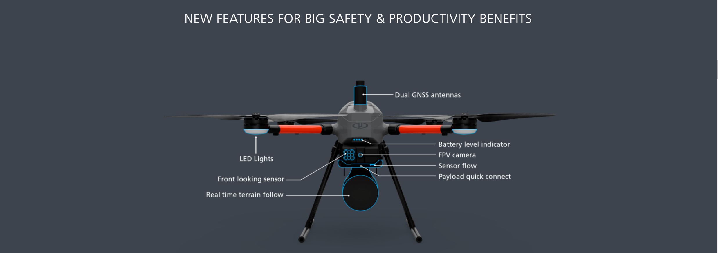
- New autopilot integrated into a single board— this means less cabling, less weight, more compactness and less risk of connection-related failures and better electromagnetic compatibility
- mdCockpit software ecosystem for mission planning and control directly integrated into the RC
- Microdrones completed all necessary testing to make md4-EasyOne a “Remote Identification Unmanned Aircraft” following FAA 14 CFR Part 89
- Payload connection/communication quick connect
- Real time terrain follow and collision awareness
- NDAA compliant RC controller options
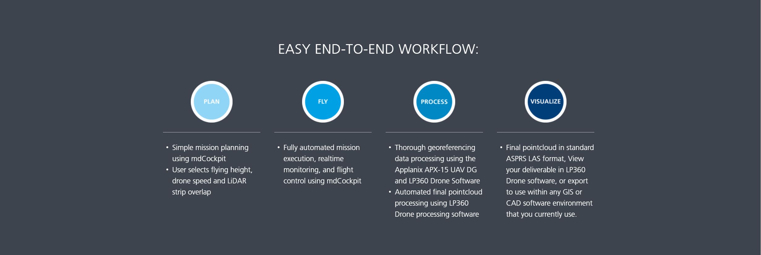
WHAT CAN YOU DO WITH IT?
EasyOneLiDARUHR+, UHR & UHR Lite are versatile packages that can be used for a wide range of applications.
- Aerial Mapping / Surveying
- Construction
- Mining
- Volumetrics
- Precision Agriculture
- Digital Twins
- Defense
THIS EasyOneLiDARUHR+ PACKAGE INCLUDES:
PLATFORM
- EasyOne Platform
- Charger & Flight Battery
- Rugged Carrying Case
- Mag-less Navigation
- Customer Support
COMMUNICATION
- Encrypted Digital Data Link
- mdRC
- Remote ID Enabled
PAYLOAD
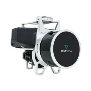
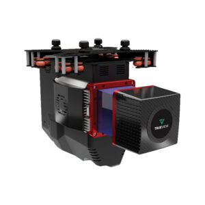
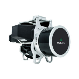
- Fully Integrated High Resolution LiDAR & Camera
- Applanix APX-15 UAV DG
SURVEY EQUIPMENT SOFTWARE
- mdCockpit Software
- Tap & Fly
DATA PROCESSING SOFTWARE INCLUDED
LP360 Drone is a powerful ecosystem that will enable you to quickly and efficiently process geospatial data. Your system will include LP360 Drone, as well as Strip Align and Desktop Photo Add-Ons.
EASYONE AIRCRAFT PLATFORM SPECS:
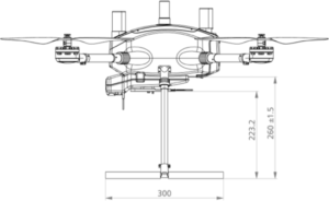

- Size:
- circle with 70 cm diameter to include all motor nacelles
- 495 mm x 495 mm from nacelle to nacelle
- 955 mm x 955 mm rotor tip to tip
- 454 mm height to top of the antenna
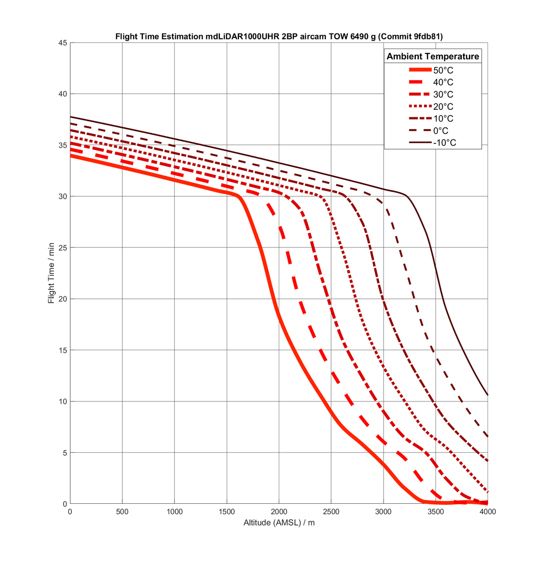
- Flight time (estimated) app. 40 min with UHR payload at our location (app. 300 m ASL)
- Packaged weight 5500 g
- Platform 2000 g
- Battery 2100 g
- Payload 1400 g
- Max take off mass 5700 g
![]()
Information / Quote Request
- Click Here for more information or a custom quotation
- Fly your drone professionally – Part 107 Certification Classes

Reviews
There are no reviews yet.