


Description
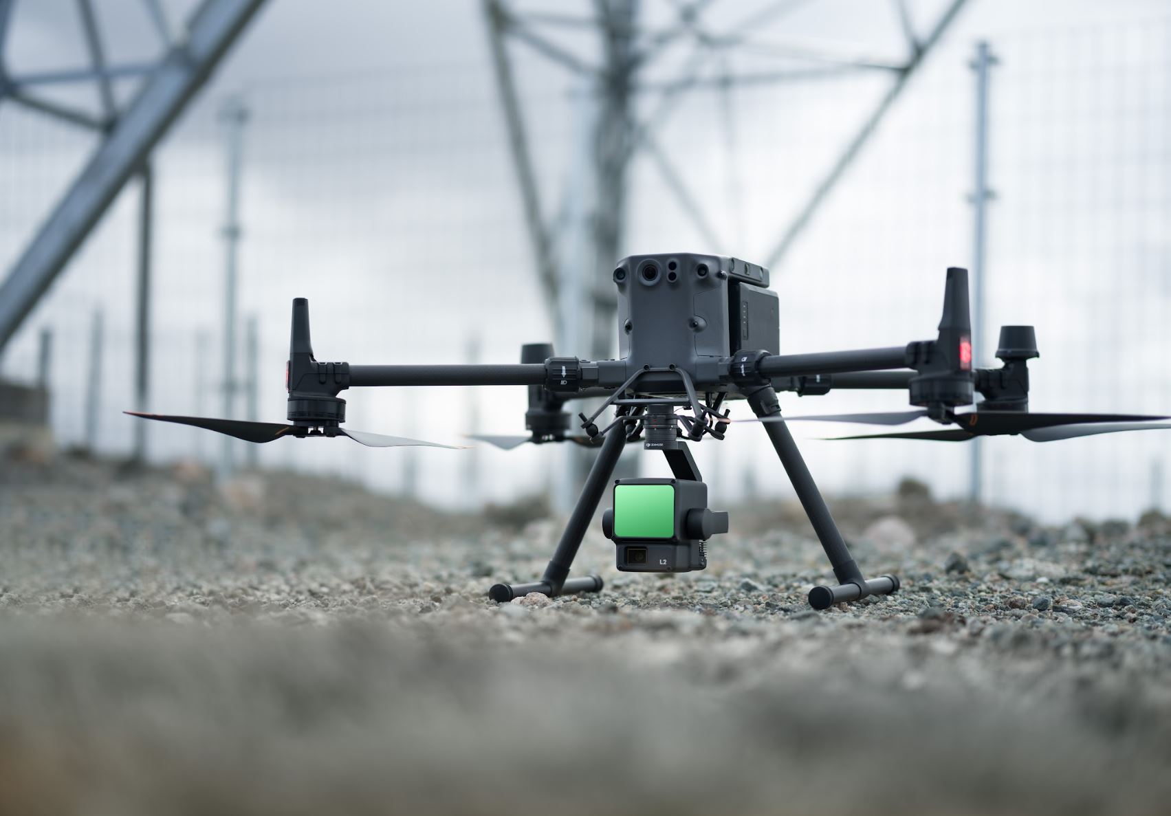
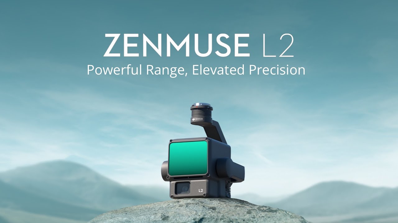
DJI Zenmuse L2 – Lidar + RGB High Precision Aerial System
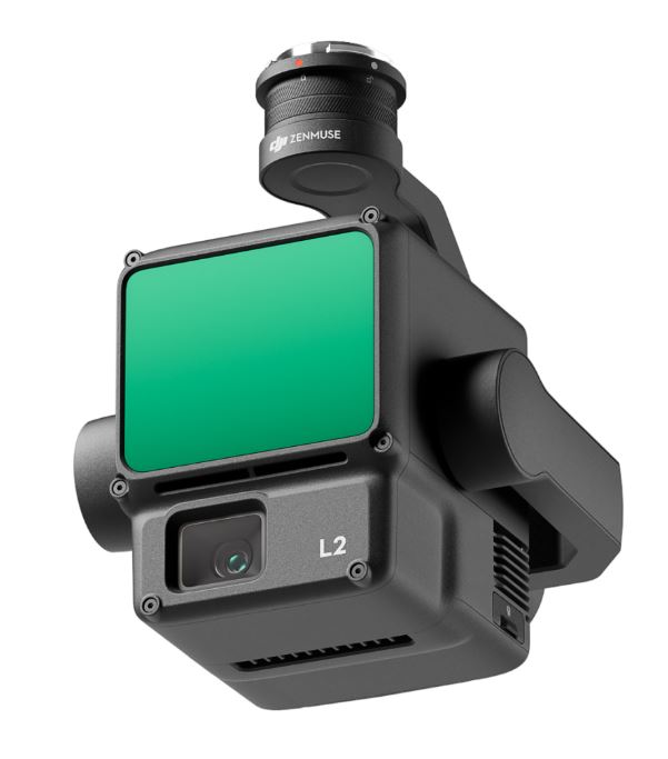
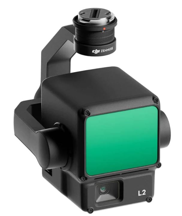
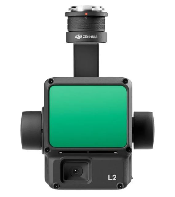
Zenmuse L2 integrates frame LiDAR, a self-developed high-accuracy IMU system, and a 4/3 CMOS RGB mapping camera, providing DJI flight platforms with more precise, efficient, and reliable geospatial data acquisition. When used with DJI Terra, it delivers a turnkey solution for 3D data collection and high-accuracy post-processing.
[su_row][su_column size=”1/4″ center=”no” class=””]
High Precision
Vertical Accuracy: 4 cm;
Horizontal Accuracy: 5 cm
[/su_column] [su_column size=”1/4″ center=”no” class=””]
Exceptional Efficiency
2.5 km2 covered in a single flight
[/su_column] [su_column size=”1/4″ center=”no” class=””]
Superior Penetration
Smaller laser spots, denser point clouds
[/su_column] [su_column size=”1/4″ center=”no” class=””]
Detection Range
250m @10% reflectivity, 100klx
450m @50% reflectivity, 0kl
[/su_column][/su_row]
[su_row][su_column size=”1/4″ center=”no” class=””]
5 Returns
[/su_column] [su_column size=”1/4″ center=”no” class=””]
Turnkey Solution
[/su_column] [su_column size=”1/4″ center=”no” class=””]
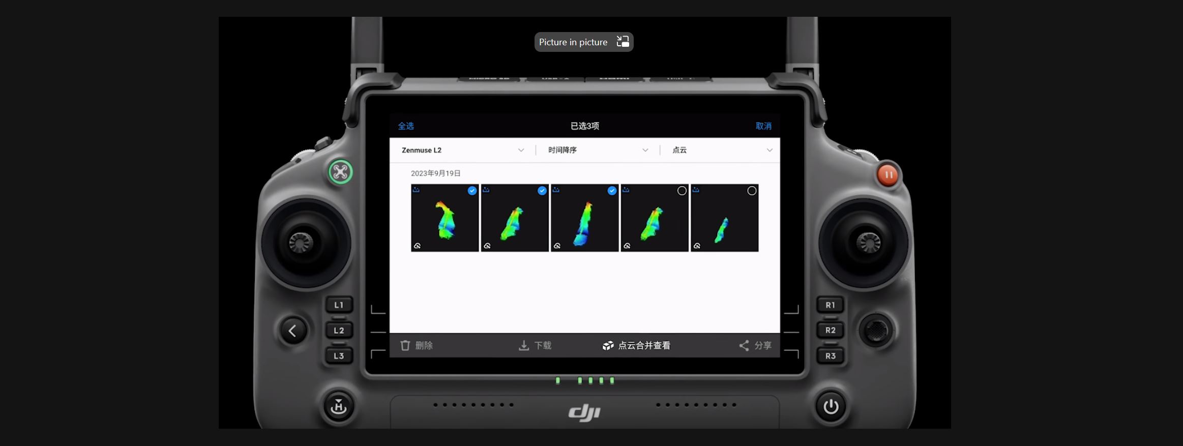
Point Cloud LiveView
[/su_column] [su_column size=”1/4″ center=”no” class=””]
One-Click Processing on DJI Terra
[/su_column][/su_row]
[su_row][su_column size=”1/1″ center=”no” class=””]
[/su_column] [/su_row]
Integrated LiDAR Solution
Supported by its powerful hardware, L2 can allow for a precise scan of complex subjects within an extended range and faster point cloud acquisition. During operations, users can preview, playback, and process point cloud models on-site, with Task Quality Reports generated by DJI Terra, offering a simple, one-stop solution to improve overall efficiency. This enables users to achieve high-precision point cloud results with one-stop post-processing.
[su_row][su_column size=”1/3″ center=”no” class=””]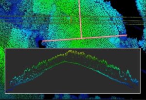 [/su_column] [su_column size=”1/3″ center=”no” class=””]
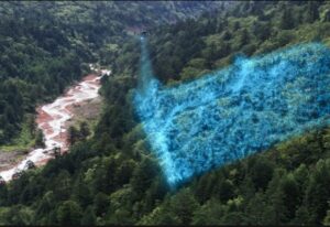 [/su_column] [su_column size=”1/3″ center=”no” class=””]
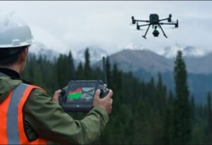 [/su_column][/su_row]
[su_row][su_column size=”1/3″ center=”no” class=””]
High-Level Precision
By combining GNSS and a high-accuracy self-developed IMU, this solution achieves 4cm vertical accuracy and 5cm horizontal accuracy.
[/su_column] [su_column size=”1/3″ center=”no” class=””]
Exceptional Efficiency
It’s ready for work as soon as it’s powered on and can collect both geospatial and RGB data from a 2.5km2 area in a single flight.
[/su_column] [su_column size=”1/3″ center=”no” class=””]
Intuitive Operation
In conjunction with Matrice 350 RTK and DJI Terra, L2 offers a turnkey solution that is simple to use, lowering the operational threshold.
[/su_column][/su_row]

[su_row][su_column size=”1/3″ center=”no” class=””]
30% Detection Range Increase
L2 can detect from 250 meters at 10% reflectivity and 100 klx, [3] and up to 450 meters at 50% reflectivity and 0 klx. [3] The typical operational altitude now extends up to 120 meters, notably enhancing operational safety and efficiency.
[/su_column][su_column size=”1/3″ center=”no” class=””]Smaller Laser Spots, Denser Point Clouds
With a reduced spot size of 4×12 cm @100m, only a fifth of that of L1, L2 not only detects smaller objects with more details, but can also penetrate denser vegetation, generating more accurate digital elevation models (DEM).[/su_column] [su_column size=”1/3″ center=”no” class=””]Supports 5 Returns
In densely vegetated areas, L2 can capture more ground points beneath the foliage.[/su_column][/su_row]
[su_row][su_column size=”1/6″ center=”no” class=””]
Diverse Flight
Route Types
[/su_column][su_column size=”1/6″ center=”no” class=””]Point Cloud
LiveView
[/su_column][su_column size=”1/6″ center=”no” class=””]Point Cloud Model
Playback and Merging
[/su_column][su_column size=”1/6″ center=”no” class=””]Auto-Generated Task
Quality Report[/su_column][su_column size=”1/6″ center=”no” class=””]PPK
Solution[/su_column][su_column size=”1/6″ center=”no” class=””]One-Click Processing
on DJI Terra
[/su_column][/su_row]
Key Features
- Ranging Accuracy (RMS 1σ)2: 3 cm @ 100 m
- Maximum Returns Supported: 3
- Scan Modes: Non-repetitive scanning pattern, Repetitive scanning pattern
- Sensor Size: 1 inch
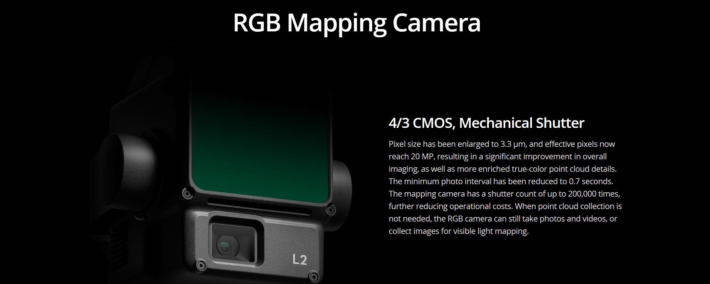
- Effective Pixels: 20 MP
- Typical: 30 W; Max: 60 W
- IP Rating – IP54
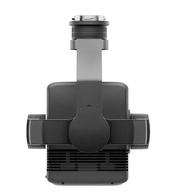
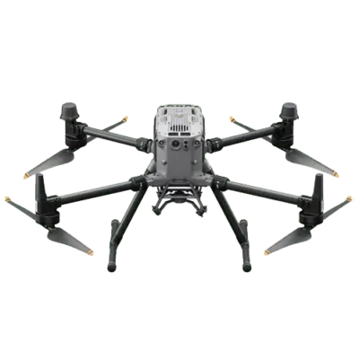
- Supported Aircraft – Matrice 300 RTK


Reviews
There are no reviews yet