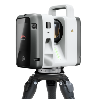
by combining the speed of the RTC360 with the high precision survey-grade” accuracy
of the Scanstation P-Series. The new RTC300, RTC500 and RTC700 allows you to
upgrade your systems capabilities through software as needed.
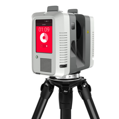
defining the standard for productivity and the future of robotic
No need to level the pole. Record points with a tilted pole.
Scan up to 30,000 points per second.


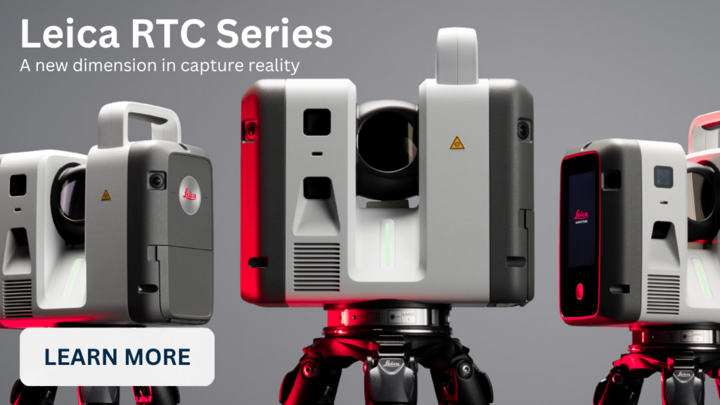
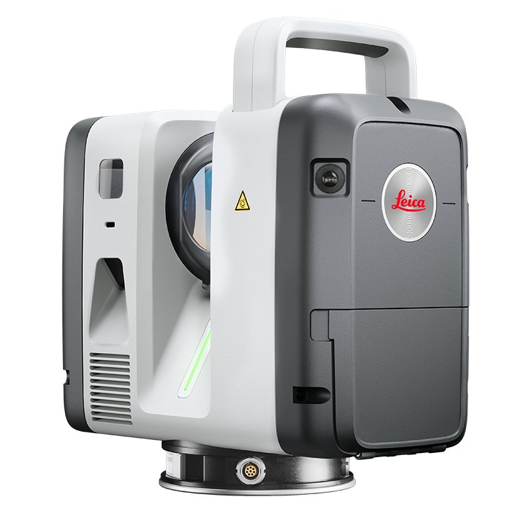
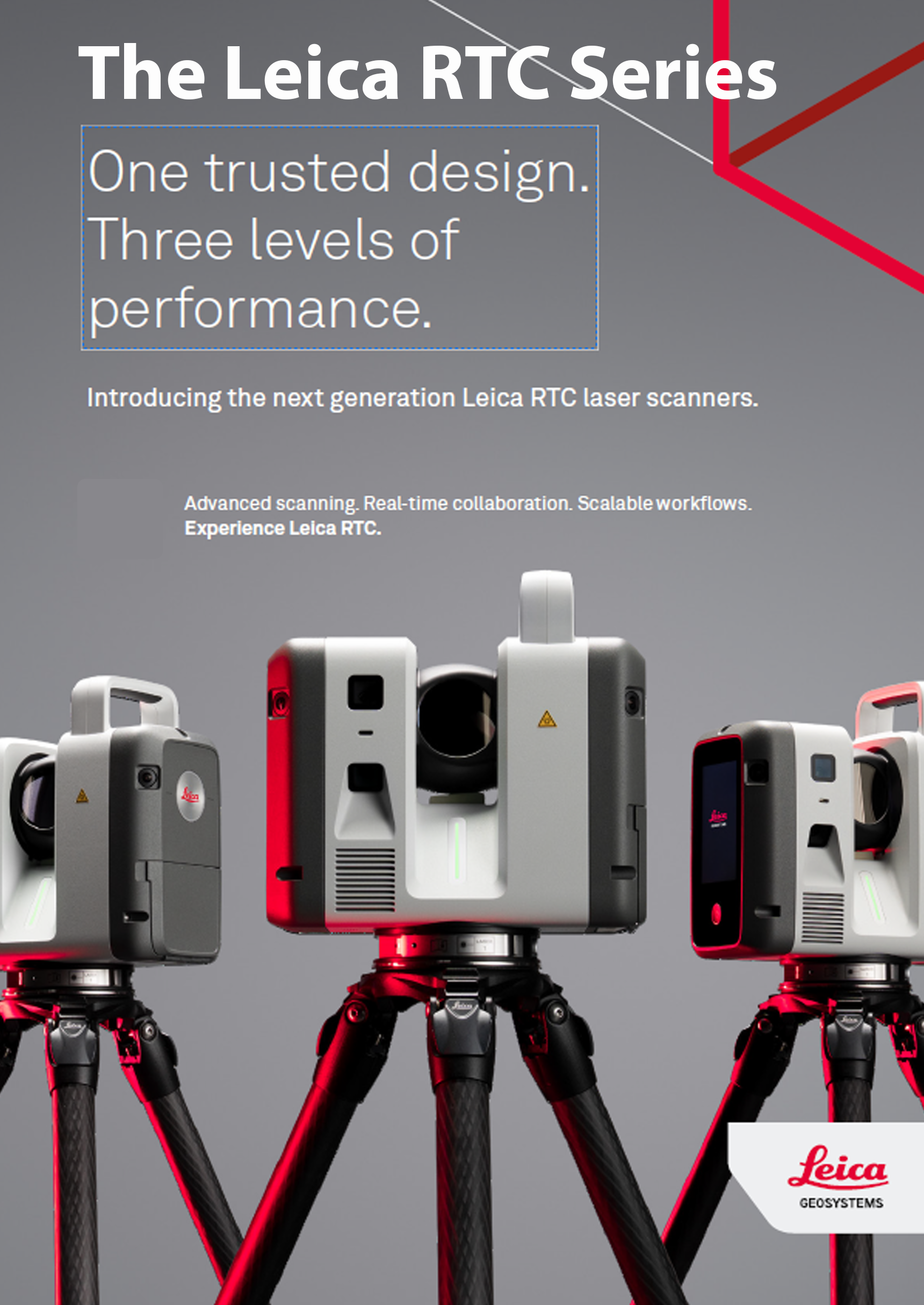
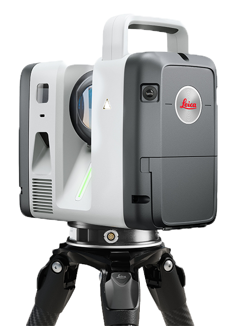
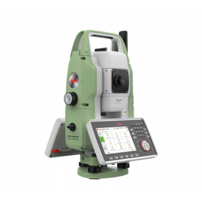
Leica RTC Series – A new dimension in reality capture
The Leica RTC Series, represents a significant evolution in terrestrial laser scanning by combining the speed of the RTC360 with the high-precision “survey-grade” accuracy of the ScanStation P-Series. This new generation introduces three scalable performance tiers—the RTC300, RTC500, and RTC700—allowing users to upgrade their system’s capabilities through software as their project demands grow without needing to replace the hardware.
- Scalable Performance Tiers: Users can choose from three levels (RTC300, 500, and 700) depending on their need for range and accuracy, with the RTC700 acting as a high-end replacement for the legacy ScanStation P-Series.
- Enhanced Speed and Accuracy: The series offers up to 35% faster data capture than competitors, maintaining a measurement rate of up to 2 million points per second and achieving full dome scans in under two minutes.
- Real-Time Cloud Connectivity: The new Livelink capability in Leica Cyclone FIELD 360 allows multiple scanners to feed into a single shared project in real time.
- What is Leica LiveLink?
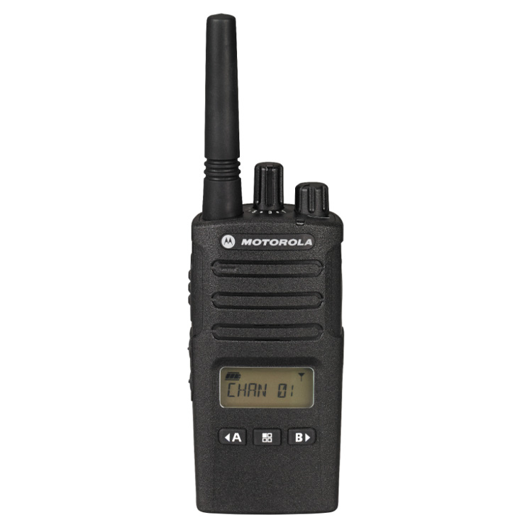
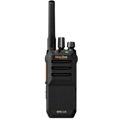
Motorola BPR50-DX Two Way Radio Package
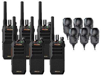
Buy 6 Radios and get 6 Speaker Microphones FREE!
The Motorola Mag One BPR50-DX is a compact, durable UHF two‑way radio designed for business environments that need reliable, long-lasting communication. They feature noise cancellation, programmable buttons, and a dedicated emergency function. Its rugged IP55 rating and USB‑C charging make it a practical choice for retail, hospitality, facilities, and event operations.
Fast, flexible equipment financing tailored to your business
![]() Kuker Ranken Inc has partnered with APPROVE to bring you flexible, customized financing solutions designed around your business’s unique goals. With our quick, 60-second application, you’ll be matched with best-fit lenders from the APPROVE network—helping ensure you receive competitive offers tailored to your needs.
Kuker Ranken Inc has partnered with APPROVE to bring you flexible, customized financing solutions designed around your business’s unique goals. With our quick, 60-second application, you’ll be matched with best-fit lenders from the APPROVE network—helping ensure you receive competitive offers tailored to your needs.
The process is simple, efficient, and built to save you time while maximizing your options. Apply today and take the next step toward equipping your business with the tools and resources it needs to grow and succeed.
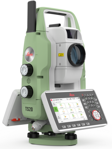
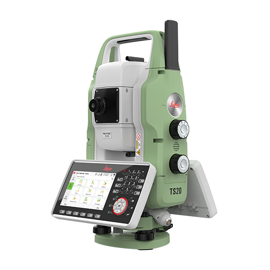
Leica TS20 Be ready for the robotic total station that defines the standard for productivity.
The New Leica TS20 is a groundbreaking robotic total station featuring edge AI, designed to enhance productivity by automating tasks and improving accuracy in challenging environments. It boasts an IP66 rating for high durability, advanced motors for speed, and seamless cloud connectivity for immediate data sharing. Ideal for surveyors, the TS20 simplifies complex workflows and reduces rework through intelligent target recognition, making it a reliable, future-ready tool.
- AI-Powered Efficiency: The TS20 utilizes AI for automatic prism recognition, minimizing errors, reducing downtime when losing lock, and allowing for faster, more accurate surveying even in difficult, partially blocked, or poor weather conditions.
- Rugged Reliability & Speed: Engineered to be the first IP66-rated robotic total station, it offers exceptional protection against dust and water, complemented by fast, maintenance-free motors and high-speed processors for maximum field uptime.
- Seamless Digital Workflow: Integrated cloud connectivity and IoT readiness facilitate instant data transfer and collaboration, allowing for instant “GeoCloud” updates that prevent costly errors and streamline office-to-field operations.
Leica TS20 Be ready for the AI powered robotic total station that defines the standard for productivity.
The New Leica TS20 is a groundbreaking robotic total station featuring edge AI, designed to enhance productivity by automating tasks and improving accuracy in challenging environments. It boasts an IP66 rating for high durability, advanced motors for speed, and seamless cloud connectivity for immediate data sharing. Ideal for surveyors, the TS20 simplifies complex workflows and reduces rework through intelligent target recognition, making it a reliable, future-ready tool.
- AI-Powered Efficiency.
- Rugged Reliability & Speed.
- Seamless Digital Workflow.
-

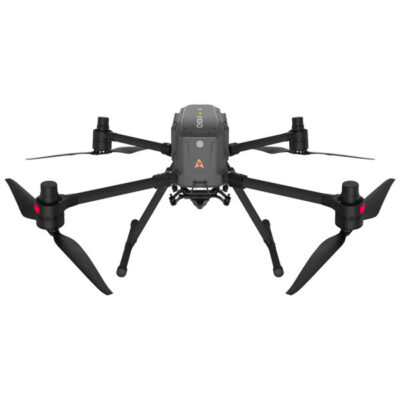
CHCNAV X500 Professional Multirotor Drone
Read more -
MagOne by Motorola BPR50DX Two-Way Radio – Business
Price range: $337.00 through $2,022.00 Select options This product has multiple variants. The options may be chosen on the product page -
Leica RTC Series
Read more -
Leica RTC360 3D Laser Scanner
Call for pricing! $78,476.65 Add to cart -
Leica TS20 Robotic Total Station – BE READY
Read more
-
Presco Texas Roll Flagging
Price range: $2.75 through $2.80 Select options This product has multiple variants. The options may be chosen on the product page -
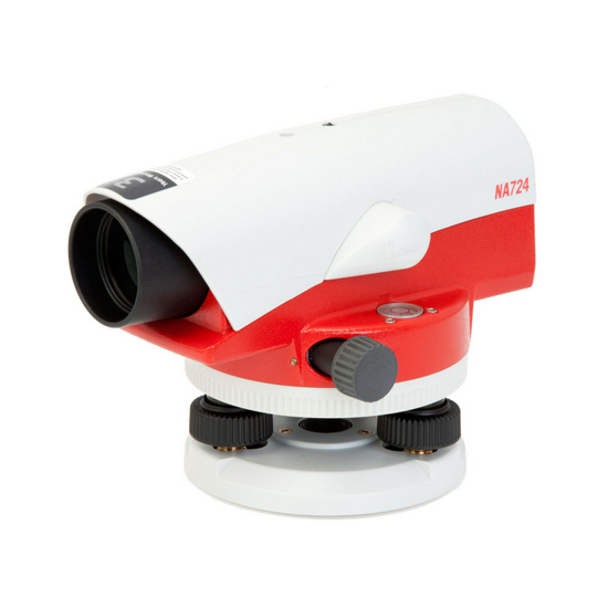
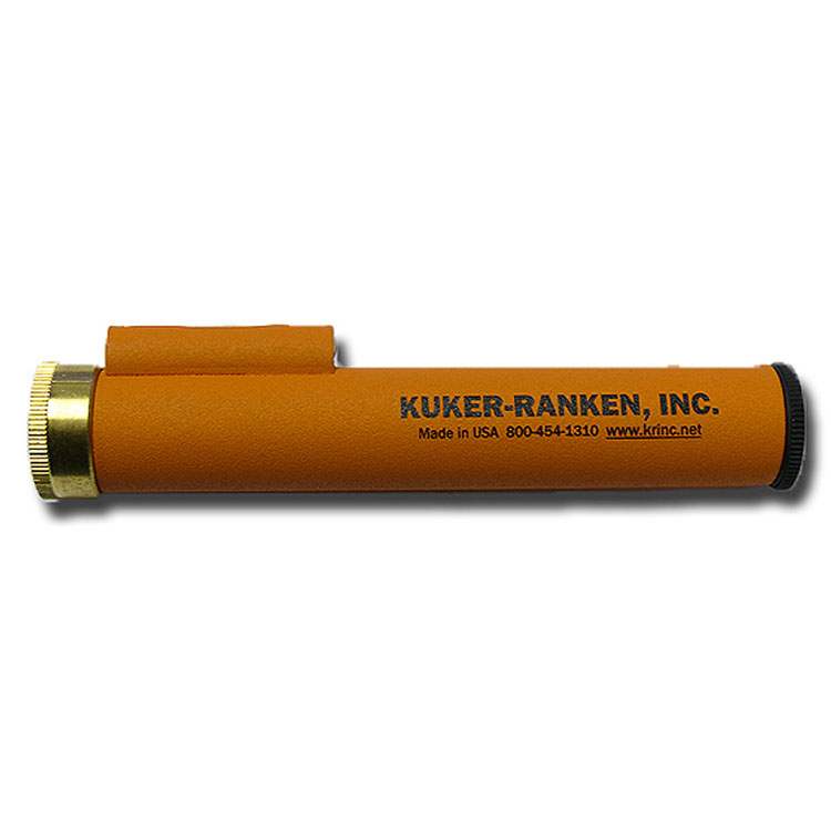
KukerRanken 572S Hand Level
$200.00 Add to cart -
Chrisnik MagNails
Prices Starting At: Price range: $10.62 through $41.46 Select options This product has multiple variants. The options may be chosen on the product page -
Genuine KukerRanken 572S Hand Level Case & Parts
Price range: $1.35 through $66.75 Select options This product has multiple variants. The options may be chosen on the product page -
Sokkia 8126-20 Plastic Plumb Line Target
$1.83 Add to cart


-
Sale!
Rite in the Rain Blaze Orange Side-Spiral Notebook #OR73
Original price was: $9.95.$7.60Current price is: $7.60. Add to cart -
Sale!
Hoodman Weighted Landing Pad (2 FT, 3 Ft, 5 Ft, or 8 Ft)
Price range: $50.99 through $429.99 Select options This product has multiple variants. The options may be chosen on the product page -
Sale!
4Hawks Super Range Extender Raptor SR for Phantom 4 Pro V2.0
Original price was: $141.00.$126.95Current price is: $126.95. Add to cart -
Sale!
Baton Traffic Flare with Red LEDs (Single)
Original price was: $55.90.$38.22Current price is: $38.22. Add to cart -
Sale!
Super Road Flare with Red LEDs (Single)
Original price was: $57.60.$29.95Current price is: $29.95. Add to cart


 Calibration & Repair
Factory-trained technicians to keep your equipment performing at its best.
Training & Support
Hands-on training and ongoing support to keep your team productive in the field.