![]()
Public Safety users of Pix4D benefit from training specifically focused on Public Safety application of the software. Different than generalized training (which misses many of the nuances and processes required for Public Safety users), focused training provides greater confidence and competency when working with Pix4DMapper. Additionally, chain of custody, CJIS-compliance, placing checks in the data capture process to create a solid data capture and analysis background, Public Safety is unique in its use of Pix4D and other analysis and modeling tools.
SMG training for Pix4D focuses on the needs of the specific vertical use. Officers, firefighters, arson investigators, detectives, CSA’s, and other public safety users of the software will find familiar language, datasets, and workflows which are common, comfortable, and consistent with other training events and exercises found in public safety programs.
TWO DAY TRAINING:
Online or in-person
In our two day training course, attendees will learn all aspects of importing, calibrating, processing, and archiving data, as well as best practices for transporting the scene datum to other internal departments and external share of data. Attendees will use data sets (supplied by SMG) relevant to public safety practices (arson, traffic, homicide), ensuring the scenarios are familiar and relevant.
Attendees will learn to properly file and label data (Pix4D transports best with a specific file structure), import data to Pix4D, properly select coordinate datums, and set up the project. Verification of data capture, how to retrieve flight verification, and ensure an entire area was properly captured, and prep for processing are all part of the first day of training.
Once the project has been set up for processing, attendees will learn the most efficient methods of prepping the data for best-practices deliverables, storing quality reports as part of the case file, and understanding process documentation.
DAY ONE TRAINING:
- Setting up folders per case/scenario
- Transferring and backing up data
- Learning the interface
- Understanding Import of Data
- Refining project settings after import
- Selecting a coordinate system/datum
- Problem solving at import
- Verifying data collection/flight path
- Storing data, flight path information
- Importing GPS data for greater precision
- First step processing/Initial Point Cloud
- Calibrating uncalibrated cameras
- Creating a processing area
- Marking control points
- Ground controls supported by GPS (total station, rover output, etc)
- Manual tie points (in the event no GPS is used)
- Reoptimizing and/or rematching images
- Second step processing
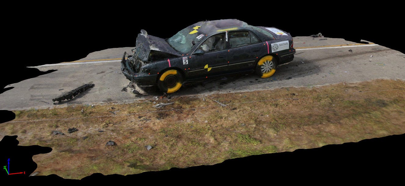
- Densified Point cloud
- Texturing
- Orthomosiac viewing
DAY TWO TRAINING:
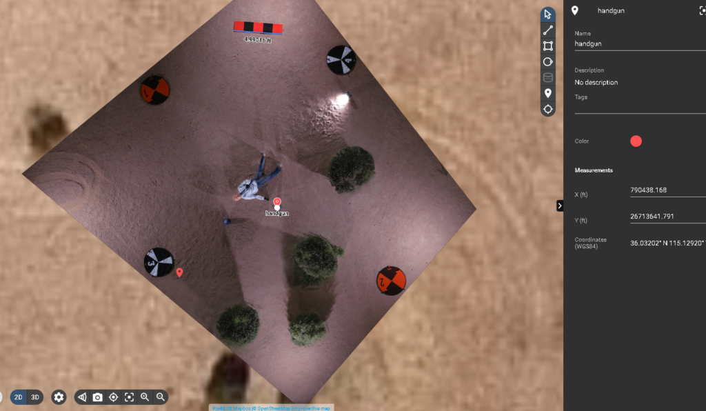
- Understanding measurements in the point cloud
- Understanding areas in the point cloud
- How Models assist viewing, and Orthos for measurement
- Cleaning the point cloud/denoising a point cloud
- Outputting a Mosiac
- Modifying/cleaning the mosiac
- Creating deliverables for local and cloud delivery
- Storing/archiving all data relevant to the project
- Exporting to other software tools
- Trouble-shooting output/deliverable issues
THREE DAY TRAINING:
Online-only, blended Online/In-person, or In-person
Our most popular offering, the three-day course provides live flight training to officers and CSA personnel.
Live flight training instructs the proper spin-up of the flight, ensuring data is cleanly captured on the first flight, with a focus on both overall scene capture for investigators, as well as data capture for measurables, evidence, and clean deliverables. In this course, attendees will also learn to co-operate remotely piloted aircraft with cell phone photos, crime scene photos, ground-based elements and other data capture. Upon completion of this course, pilots should be confident and competent in the planning and execution of flight for clean, quality-driven data capture, and processing of images for photogrammetry and point cloud delivery in various formats.
DAY ONE TRAINING: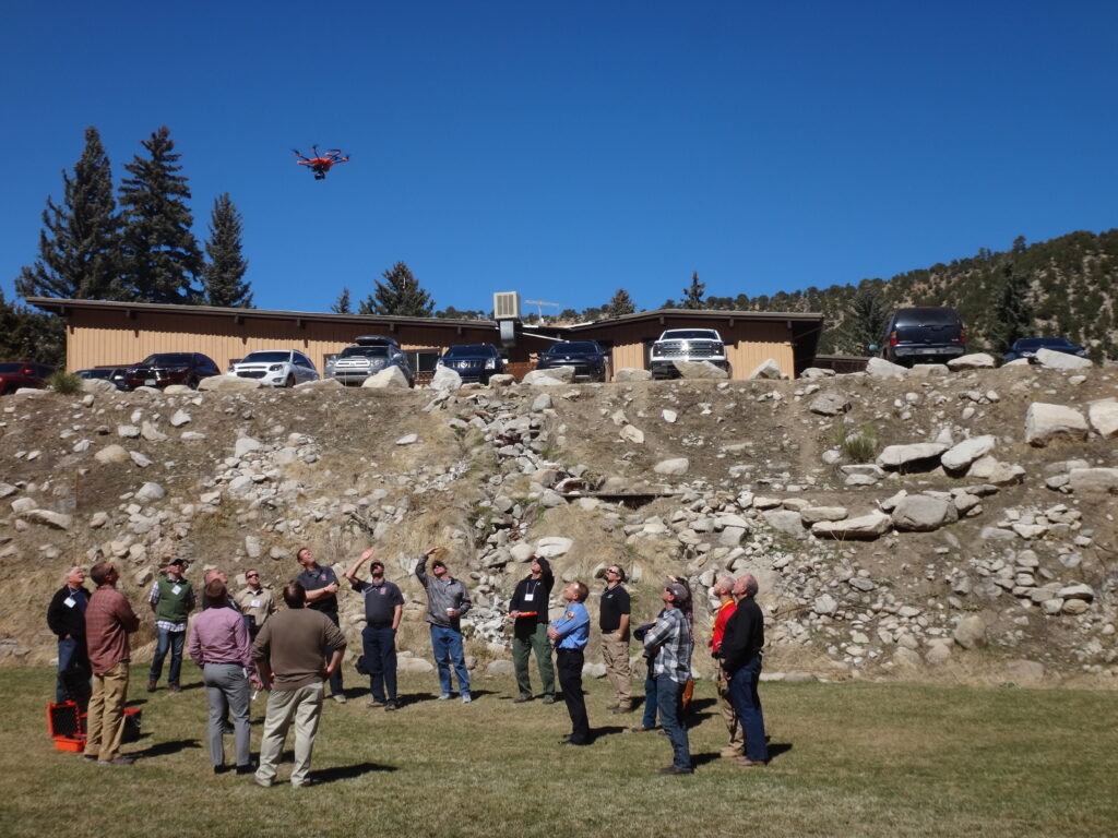
- Assessing the scene (safety)
- Risk mitigation
- Determining environmental impacts on data capture (wind, rain, night time, mid-day)
- Camera settings for optimal capture/Setting up the camera for manual capture
- Best practices for camera use
- Night capture
- Placement of controls and verification devices
- Planning the mission/flight
- Secondary capture (terrestrial), hand-held UA capture, and tertiary camera capture
- Storing the mission plan/flight data for the case file
- Capturing GPS data (where applicable) in scenes for precision and accurate measurement and terrestrial placement
- Executing the mission*
- Video capture of the scene
- On-scene verification of data capture
- Data backup
- Folder structure for Pix4D import
*The in-person class includes live flight/training. SMG provides aircraft
DAY TWO TRAINING:
- Setting up folders per case/scenario
- Transferring and backing up data
- Learning the interface
- Understanding Import of Data
- Refining project settings after import
- Selecting a coordinate system/datum
- Problem solving at import
- Verifying data collection/flight path
- Storing data, flight path information
- Importing GPS data for greater precision
- First step processing/Initial Point Cloud
- Calibrating un-calibrated cameras
- Creating a processing area
- Marking control points
- Ground controls supported by GPS (total station, rover output, etc)
- Manual tie points (in the event no GPS is used)
- Reoptimizing and/or rematching images
- Second step processing
- Densified Point cloud
- Texturing
- Orthomosiac viewing
DAY THREE TRAINING:
- Understanding measurements in the point cloud
- Understanding areas in the point cloud
- How Models assist viewing, and Orthos for measurement
- Cleaning the point cloud/denoising a point cloud
- Outputting a Mosiac
- Modifying/cleaning the mosiac
- Accessing video data for Pix4D processing
- Annotating evidence and elements of a scene
- Creating deliverables for local and cloud delivery
- Ortho
- 3D Model
- Storing/archiving all data relevant to the project
- Exporting to other software tools
- Trouble-shooting output/deliverable issues

Pix4DReact training is included in our Pix4DMapper classes for Public Safety at no additional cost.
Contact KukerRanken Portland or KukerRanken Las Vegas for information, dates, costs, and training programs.
Pricing is structured for municipalities, agencies, and individuals.
All training is bespoke; manuals, work product, and curriculum is variable by agency or individual needs. Prior to scheduling a training course, we prefer to discuss specific needs for specific courses in order to ensure agency expectations, CE, and other and needs are clearly met.


 [su_button url=”https://www.eventbrite.com/cc/kukerranken-roadshow-2022-815729″ background=”#2defd4″ color=”#000000″ size=”4″ center=”yes”]More Information[/su_button]