

Showing 25–36 of 53 results
GeoCue’s TrueView 515 is simply the best performing LIDAR/Camera system in the mid price range. This compact 3D Imaging System has impeccable definition along wires, superior ground cover beneath vegetation and sensitivity like we’ve never seen in this class system.
![]()
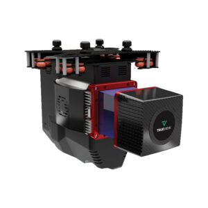
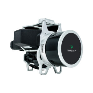
The TrueView® 655/660 is GeoCue’s third generation RIEGL integration built with the miniVUX-3UAV and triple mapping cameras (right, left, nadir) for high accuracy mapping with excellent vegetation penetration and wire detection in a lightweight payload package.
![]()
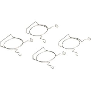
Drone Tape Clips support movable Drone Flight Zone Tape Boundaries. Lightweight, reusable cone inserts hod barricade tape at the top of traffic cones to define boundaries that alert people of areas to stand clear of. Galvanized spring steel wire inserts are rustproof and universally mount in all 3″ or less traffic cone top holes.
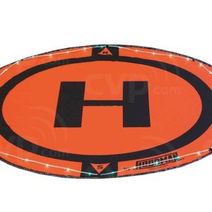
Hoodman Launch Pad Light Kits are an easy way to illuminate your home base. Low-level LED green lights improve vision detail and clarity without shutting down your night vision pupil dilation. FAA Heliport lights are green for the same reason.
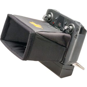
The Hoodman Sunshade Hood model HSC300 mounts magnetically to DJI Smart Controllers to give drone pilots the best glare free outdoor viewing possible. Hoodman’s 4- sided Hood blocks light from the screen from all 4 sides. The bottom panel cut out facilitates touch screen access without compromising glare relief.
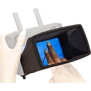
The Hoodman Sunshade Hood model HSC mounts magnetically to DJI Smart Controllers to give drone pilots the best glare free outdoor viewing possible. Hoodman’s 4- sided Hood blocks light from the screen from all 4 sides. The bottom panel cut out facilitates touch screen access without compromising glare relief.
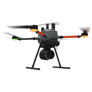
This is Microdrones best LiDAR drone surveying equipment ever. Built upon their 4th-gen drone technology, all MicroDrone EasyOne systems are more compact, more optimized, lighter, safer and more efficient.
![]()
The mdLiDAR1000UHR can help streamline your current workflow to become more efficient, while helping you to complete more projects.
![]()
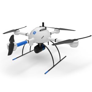
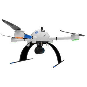
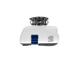
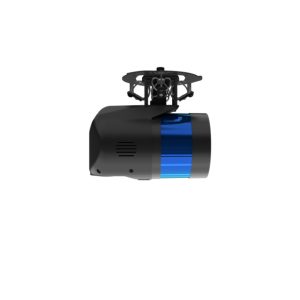
GE Industrial Drone Line – Proven industry leading drone lidar survey equipment and software. mdLiDAR1000HR: HR means high resolution pointclouds and increased coverage is made easier and more accessible than ever.
Microdrones
Get survey-grade results from images
*Your activation code will be emailed to you within 48 hours (PST) from the receipt of your order.
![]()
![]()
21601 66th Ave. West, Unit A
Mountlake Terrace, WA 98043
United States
Toll Free: 800-454-1310