


Showing 13–24 of 53 results
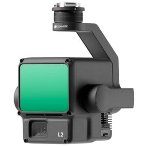
A Lidar + RGB Solution for High-Precision Aerial Surveying
Zenmuse L2 integrates frame LiDAR, a self-developed high-accuracy IMU system, and a 4/3 CMOS RGB mapping camera, providing DJI flight platforms with more precise, efficient, and reliable geospatial data acquisition. When used with DJI Terra, it delivers a turnkey solution for 3D data collection and high-accuracy post-processing.
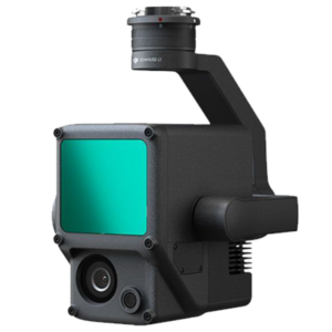
A Lidar + RGB Solution for Aerial Surveying
The Zenmuse L1 integrates a Livox Lidar module, a high-accuracy IMU, and a camera with a 1-inch CMOS on a 3-axis stabilized gimbal. When used with Matrice 300 RTK and DJI Terra, the L1 forms a complete solution that gives you real-time 3D data throughout the day, efficiently capturing the details of complex structures and delivering highly accurate reconstructed models.
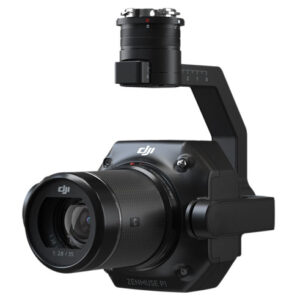
DJI Zenmuse P1
The Zenmuse P1 integrates a full-frame sensor with interchangeable fixed-focus lenses on a 3-axis stabilized gimbal. Designed for photogrammetry flight missions, it takes efficiency and accuracy to a whole new level.
EVO II DUAL Radiometric Enterprise Bundle
![]()
Equipped with an 8K sensor for high resolution and a FLIR Boson radiometric sensor for thermal imaging up to 640×512, the Dual R is built to deliver incredible detail in any environment—night or day
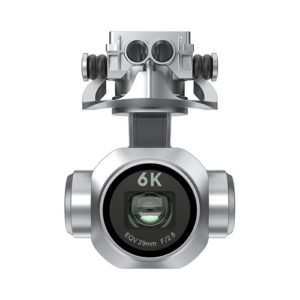
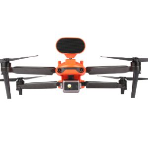
Elevate your content by taking to the sky with the Autel Robotics EVO II V3 6K Gimbal Camera as the payload on your EVO II drone.
Designed for the Matrice 30 series these TB30 Batteries by DJI are hot-swappable to allow pilots to change batteries while the drone is still to save time during critical missions.
![]()
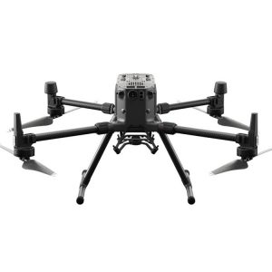
The Matrice 300 RTK offers up to 55 minutes of flight time, advanced AI capabilities, 6 Directional Sensing & Positioning and more.
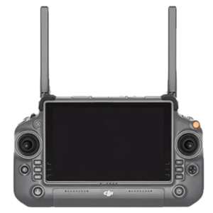
The DJI RC Plus Remote Controller with a 7-inch large high-bright screen is designed for industry users and supports Dual Operator mode.
![]()
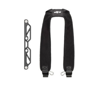
The strap can be attached to the DJI RC Plus Remote Controller, allowing users to carry the remote controller on the back to free the hands and focus on maneuvering the aircraft. The shoulder strap is firm and does not press against the neck.
![]()
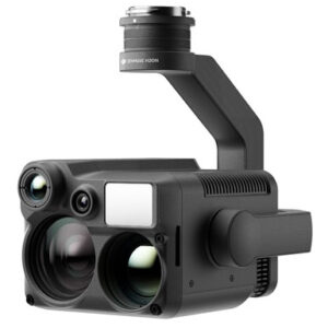
“N” for Night Vision The Zenmuse H20N integrates starlight sensors1 into its zoom and wide-angle cameras. Pair this with dual zoom thermal cameras and a laser rangefinder, and you have a versatile hybrid payload that rises to the occasion.![]()
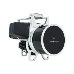
TrueView 435 is the most economical platform for utility-grade mapping. GeoCue’s TrueView 435 is our next generation compact 3D Imaging System that has sensitivity needed for infrastructure mapping. In addition, its superior ground capturing capabilities for lightly vegetated areas make this the most economical platform for utility grade-mapping.![]()
![]()
21601 66th Ave. West, Unit A
Mountlake Terrace, WA 98043
United States
Toll Free: 800-454-1310