


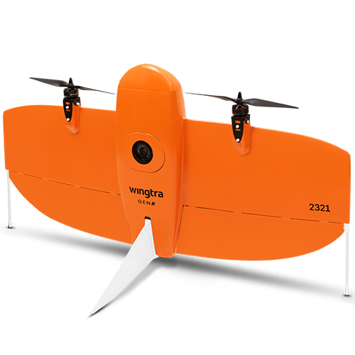
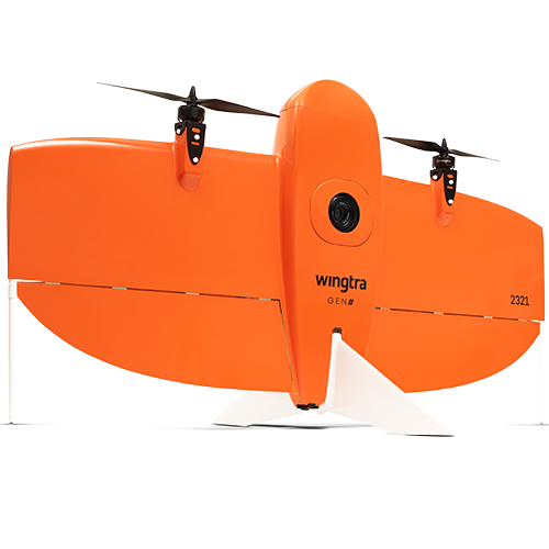
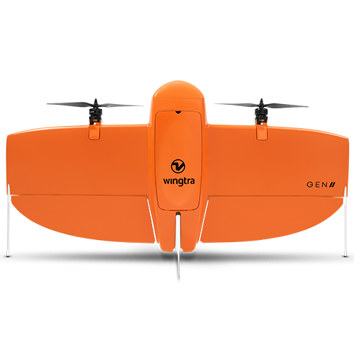
Description
![]()
Get your survey data faster
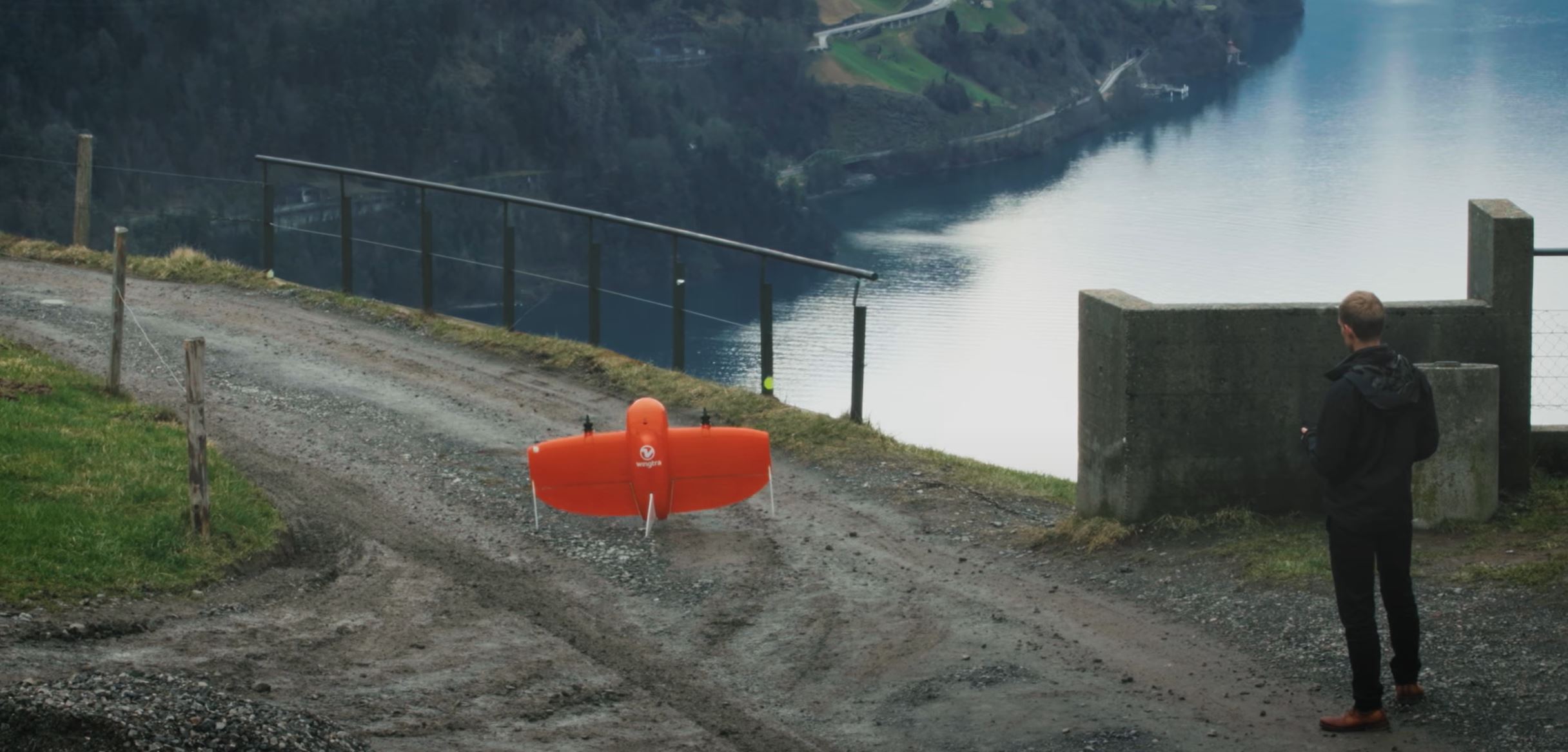
The WingtraOne mapping drone’s unique set of features empowers you to minimize your time flying and get more work done, be it another project in the field or analyzing your data at the office.
Vertical Take Off and Landing
Efficient fixed-wing flight
Fly at 16 m/s (36 mph) for up to 59 minutes per flight for large coverage.
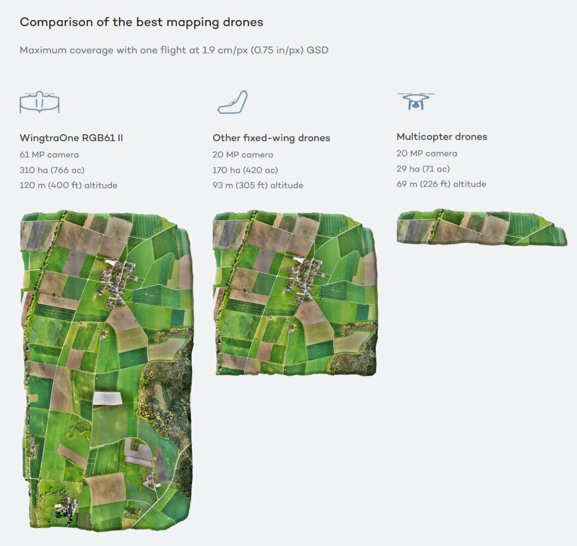
61 MP camera
WingtraOne can fly higher than drones limited to 20 MP cameras, so you capture more ground and more detail with every picture and a larger area per flight.
No more GCPs, checkpoints only
With an onboard high-precision PPK GNSS receiver you no longer need to lay out ground control points (GCPs). Use as few as three checkpoints to verify your map quality.
Lower image overlaps
High quality optics means you can reconstruct your map reliably even with lower overlaps. This means more new ground covered per flight line and maximum coverage per flight.
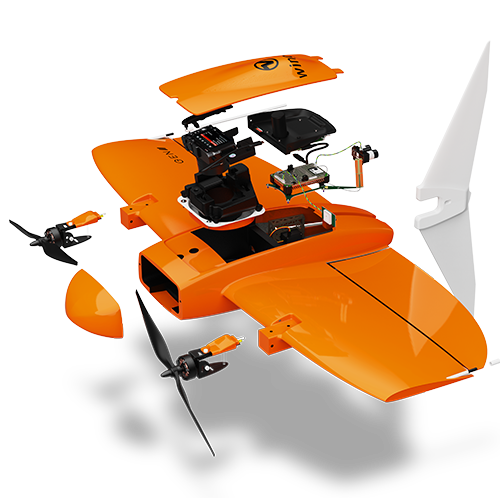
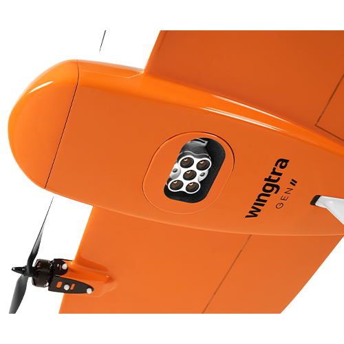
Payloads
High quality, swappable and durable
[su_row][su_column size=”1/3″ center=”no” class=””]Unwavering aerial image quality
Thanks to its heavy payload capacity, WingtraOne GEN II carries the highest quality cameras on the market.[/su_column] [su_column size=”1/3″ center=”no” class=””]Easy to swap
Easily change cameras in the field. Get the flexibility of an exceptionally high resolution RGB cameras or leading edge multispectral imagery.[/su_column] [su_column size=”1/3″ center=”no” class=””]Protected from landing shock
Thanks to the smooth vertical landing, your high-quality cameras are always protected, even in rough environments, ensuring a longer lifespan.[/su_column] [/su_row]
[su_row][su_column size=”1/3″ center=”no” class=””]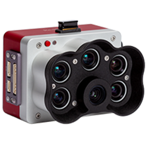 [/su_column] [su_column size=”1/3″ center=”no” class=””]
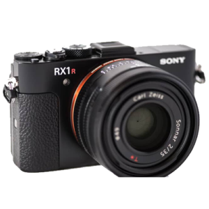 [/su_column] [su_column size=”1/3″ center=”no” class=””]
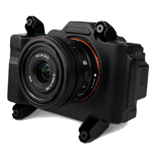 [/su_column] [/su_row]
[su_row][su_column size=”1/3″ center=”no” class=””]MicaSense RedEdge – P Pacchromatic band of 2cm at 200ft. Global shutter. Excellent for MultiSpectral/Cop monitoring[/su_column] [su_column size=”1/3″ center=”no” class=””]Sony RX1R II 42.2mp / 32mm F2 lens. Tried and true staple of the industry for Photogrammetry. Great for budget conscious large area mapping.[/su_column] [su_column size=”1/3″ center=”no” class=””]Sony RGB61 61mp. Allows user to be more efficient by flying higher while mainting GSD. Excellent for extreme large are mapping.[/su_column] [/su_row]
Easily change cameras in the field
[su_row][su_column size=”1/3″ center=”no” class=””]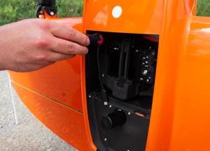 [/su_column] [su_column size=”1/3″ center=”no” class=””]
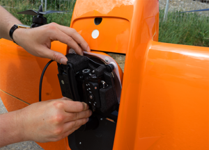 [/su_column] [su_column size=”1/3″ center=”no” class=””]
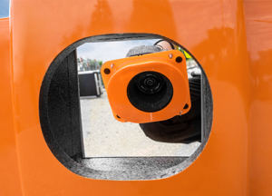 [/su_column] [/su_row]
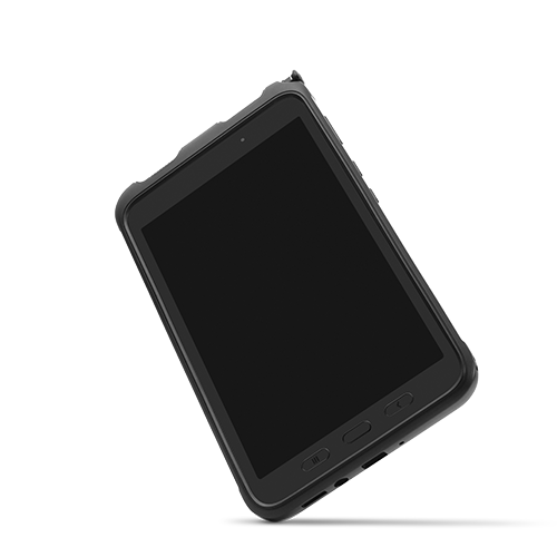
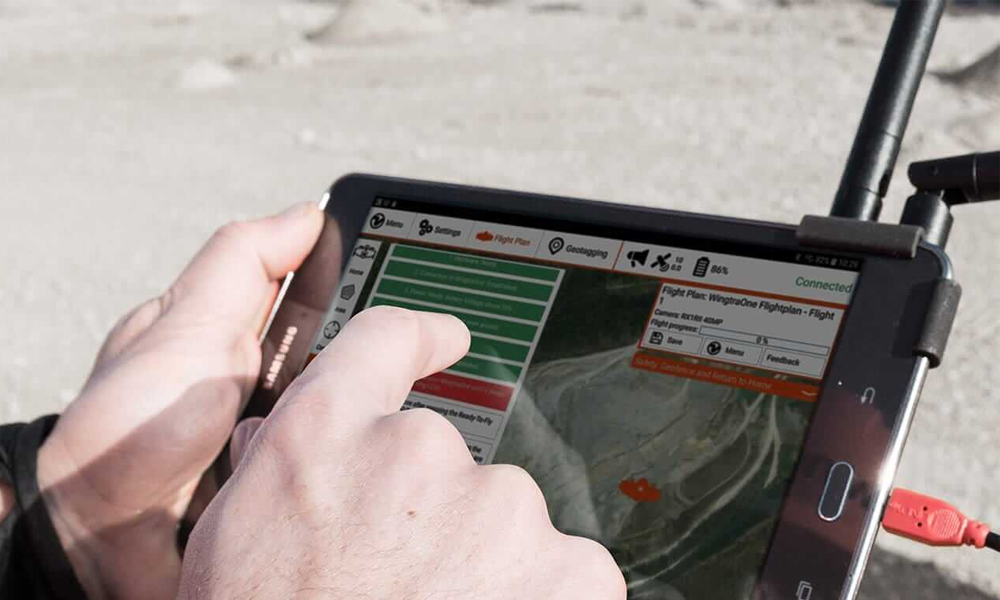
Ready to fly in five minutes
The WingtraOne drone comes with a tablet featuring WingtraPilot, the built-in app for easily managing data acquisition. The intuitive app includes various ways to prepare flight plans as well as monitor and review missions during flight.
Software
Centralized Hub
Flight Planning | Flight Execution | PPK / Geotagging
Cut your costs
Faster data collection and expanded coverage mean fewer people in the field for less time, lowering the man-hour costs associated with data collection.
Payload Safety
[su_row][su_column size=”1/2″ center=”no” class=””] [/su_column] [su_column size=”1/2″ center=”no” class=””]WingtraOne’s camera never comes into contact with the ground, meaning no debris scratching your camera lens and thus a longer equipment lifetime.
WingtraOne is an easy-to-use vertical take-off and landing (VTOL) drone that maps and delivers consistent, high-quality survey data faster, and at a lower cost, than other surveying tools.[/su_column] [/su_row]
Equipment Reliability
[su_row][su_column size=”1/2″ center=”no” class=””]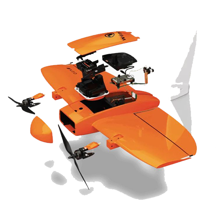 [/su_column] [su_column size=”1/2″ center=”no” class=””]A drone you can rely on. No matter the conditions, WingtraOne operates safely and delivers high-quality data, consistently. Engineered and assembled in Switzerland.
Each fixed-wing drone is subjected to more than 300 rigorous tests to ensure the highest quality standard. Industry-leading reliability. More than 100,000 flights and 6 years of continuous testing and enhancements will ensure maximum up-time for your operations.[/su_column] [/su_row]
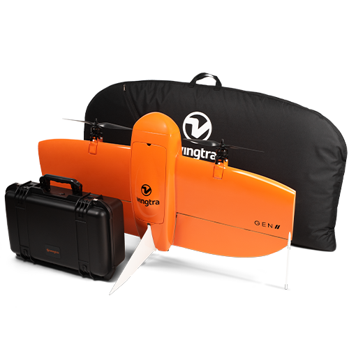
What’s included in the bundle:*
- 1x WingtraOne drone
- X payload(s) of your choice
- 1x carrying sleeve
- 1x carrying case for accessories (pilot box)
- 1x tablet including flight planning software WingtraPilot
- 1x telemetry module (2.4 Ghz)
- 2x pairs of batteries
- 1x charging station
- 5 small tools
- Basic online training
*Standard bundles. Custom bundled equipment contents may vary.
Wingtra Information
Multiple Bundles Available. Contact us for additional information or a customized quote designed for your needs.
Information/Quote request.
- WingtraOne UAV bundle with Sony RX1R II
- WingtraOne UAV bundle with Sony a6100
- WingtraOne UAV bundle with Sony a6100 Oblique
- WingtraOne UAV bundle with RGB61 powered by Sony
- WingtraOne UAV bundle with MicaSense RedEdge-P
Additional Wingtra Information.
![]()


Reviews
There are no reviews yet