


Description
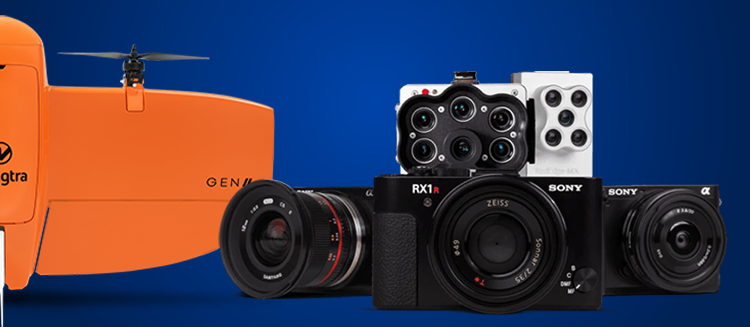
Wingtra Payloads / Sensors
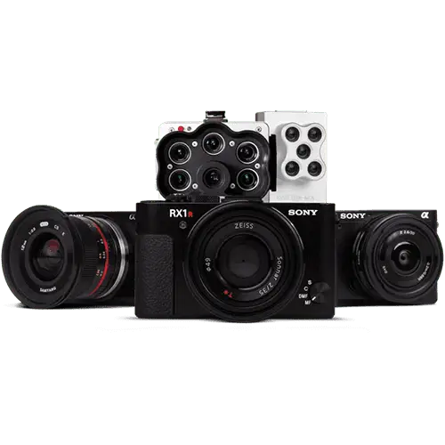
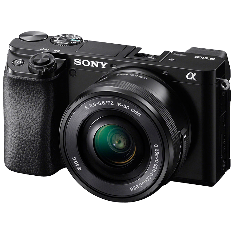
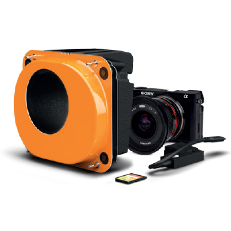
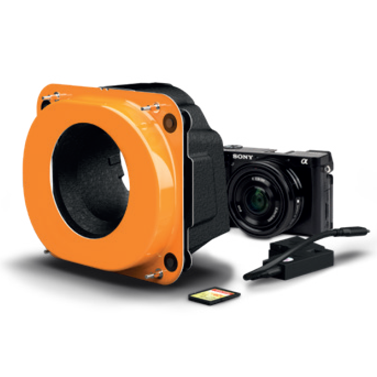
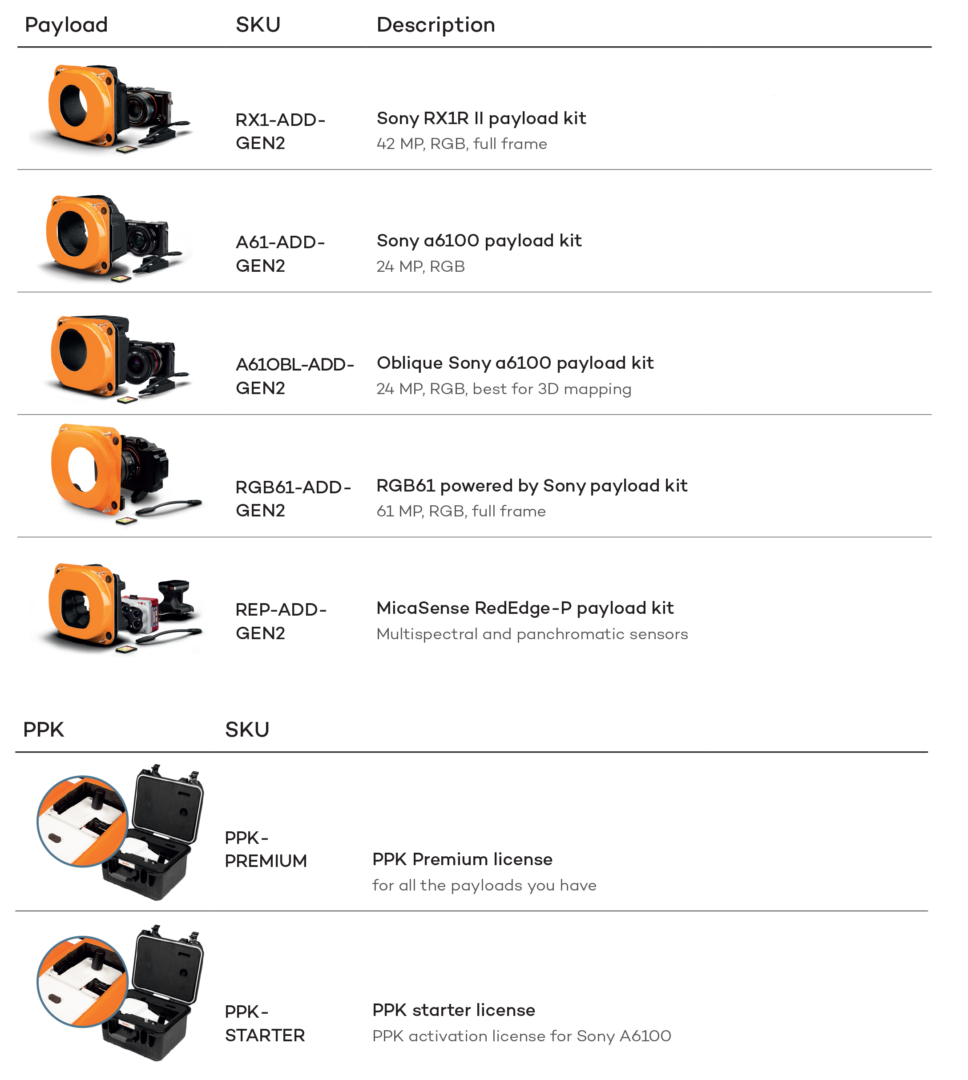
Best-in-class cameras – Achieve higher resolution and accuracy aerial survey results with the RGB61 61 MP full-frame, Oblique Sony a6100 and other best-in-class mapping cameras.
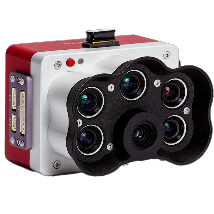
Wingtra sensors are engineered to deliver exceptional aerial imaging performance, combining precision, versatility, and reliability for professional mapping and surveying applications. Designed to integrate seamlessly with the WingtraOne Gen II drone, these sensors include advanced multispectral, RGB, and thermal options—such as the MicaSense RedEdge-P, Altum, and high-resolution payloads—allowing users to capture accurate, detailed data in a single flight. Whether used for agriculture, environmental monitoring, or infrastructure inspection, Wingtra sensors provide superior ground sampling distance, radiometric accuracy, and PPK-enabled georeferencing to ensure every image translates into actionable insights. Built for efficiency and consistency, they empower professionals to achieve higher-quality results with fewer flights and maximum coverage.
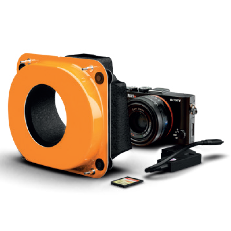
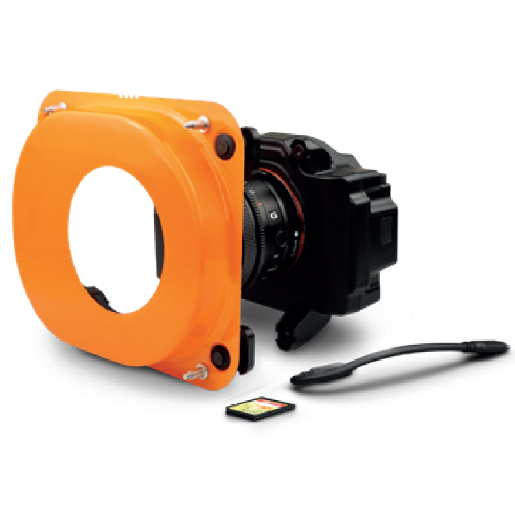
High quality, swappable and durable
[su_row][su_column size=”1/3″ center=”no” class=””] [/su_column][su_column size=”1/3″ center=”no” class=””]
 [/su_column] [su_column size=”1/3″ center=”no” class=””]
 [/su_column][/su_row]
[su_row][su_column size=”1/3″ center=”no” class=””]Unwavering aerial image quality
Thanks to its heavy payload capacity, WingtraOne GEN II carries the highest quality cameras on the market.[/su_column][su_column size=”1/3″ center=”no” class=””]Easy to swap
Easily change cameras in the field. Get the flexibility of an exceptionally high resolution RGB cameras or leading edge multispectral imagery.[/su_column][su_column size=”1/3″ center=”no” class=””]Protected from landing shock
Thanks to the smooth vertical landing, your high-quality cameras are always protected, even in rough environments, ensuring a longer lifespan.[/su_column] [/su_row]
[su_row][su_column size=”1/3″ center=”no” class=””]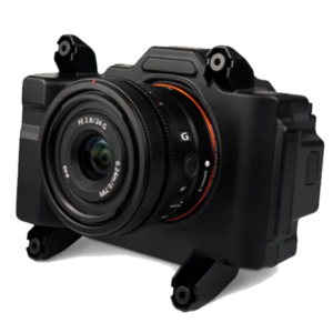 [/su_column][su_column size=”1/3″ center=”no” class=””]
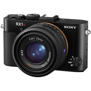 [/su_column] [su_column size=”1/3″ center=”no” class=””]
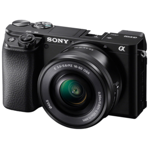 [/su_column][/su_row]
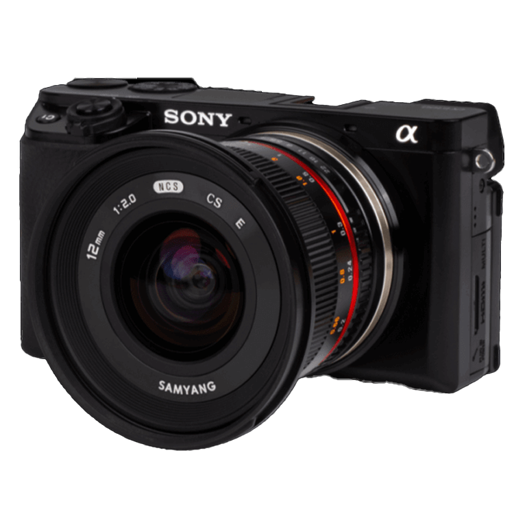
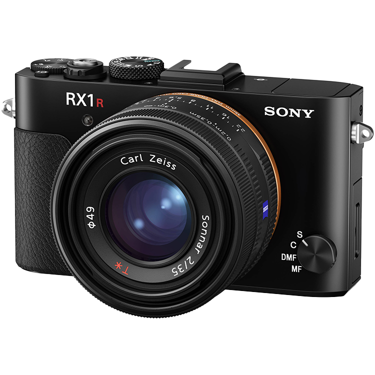
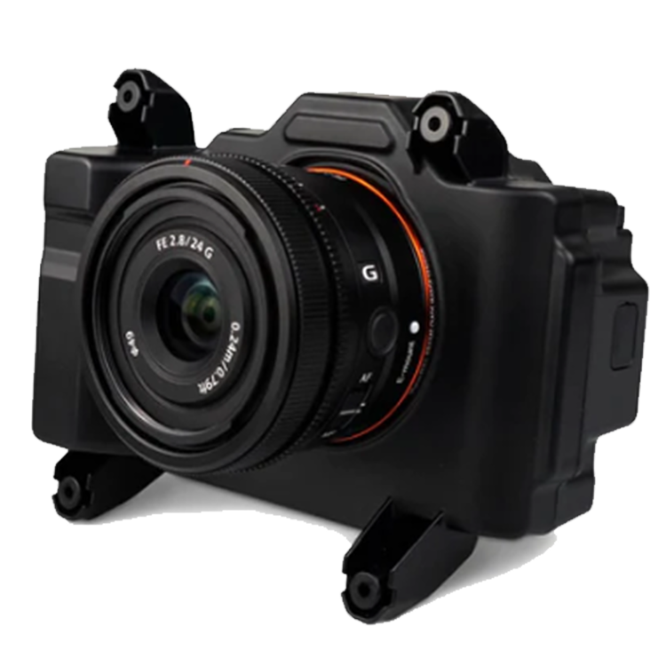
[su_row][su_column size=”1/3″ center=”no” class=””]RGB61[/su_column][su_column size=”1/3″ center=”no” class=””]Sony RX1R II[/su_column] [su_column size=”1/3″ center=”no” class=””]Sony a6100[/su_column][/su_row]
[su_row][su_column size=”1/3″ center=”no” class=””]High accuracy and most efficient[/su_column][su_column size=”1/3″ center=”no” class=””]High accuracy[/su_column] [su_column size=”1/3″ center=”no” class=””]Most affordable[/su_column][/su_row]
| Sensor | 61MP
Full-frame sensor |
42MP
Full-frame sensor |
24MP
APS-C sensor |
| GSD down to | 0.7 cm/px | 0.7 cm/px | 1.2 cm/px |
| Absolute horizontal/vertical accuracy down to | 1 cm / 3 cm (a) | 1 cm / 3 cm (a) | 2 cm / 4 cm (a) |
| Maximum coverage at 120 m | Up to 310 ha
at 1.9 cm GSD |
Up to 220 ha
at 1.6 cm GSD |
Up to 240 ha
at 2.4 cm GSD |
(a) This level of accuracy is achievable under optimal conditions, on hard surfaces, using a well-established base station or data from CORS network. A minimum of three ground points should be used as checkpoints to verify and prove the accuracy of the project. This level of accuracy can be achieved with WingtraOne GEN II only and its built-in GNSS PPK module.
| Oblique Camera | |
| 3D models Point clouds Digital surface models |
Optimized to map vertical structures, the Oblique Sony ɑ6100 allows you to generate high-resolution 3D meshes with centimeter-level absolute accuracy. |
[su_row][su_column size=”1/3″ center=”no” class=””][/su_column][su_column size=”1/3″ center=”no” class=””]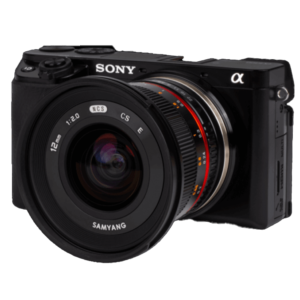 [/su_column][su_column size=”1/3″ center=”no” class=””][/su_column] [/su_row]
For high-resolution 3d models
| Sensor | 24MP APS-C sensor |
| GSD down to | 1.6 cm/px |
| Absolute horizontal/vertical accuracy down to | 2 cm / 4 cm (a) |
| Maximum coverage at 120 m | Up to 240 ha at 2.4 cm/px GSD |
| Multispectral Cameras | |
| Index map (NDVI) Chlorophyll map NDRE, OSAVI, NIR, CIR Weeds ½s Digital surface models |
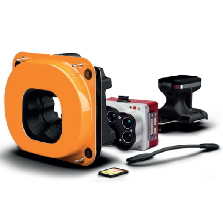
WingtraOne integrates the industry-leading cameras from MicaSense, providing optimal spectral and spatial resolution for aerial mapping applications such as agriculture, forestry, environmental research and water management. |
[su_row][su_column size=”1/3″ center=”no” class=””][/su_column][su_column size=”1/3″ center=”no” class=””]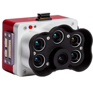 [/su_column][su_column size=”1/3″ center=”no” class=””][/su_column] [/su_row]
High-resolution multispectral and panchromatic sensor
| Multispectral Sensor | 5 bands
Blue, green, red, red edge, near-infrared (NIR) |
| Panchromatic Sensor | Panchromatic band
5.5 mm lens |
| GSD down to | 2 cm/px |
| Absolute horizontal/vertical accuracy down to | 3 cm / 6 cm (a) |
| Maximum coverage at 120 m | Up to 160 ha at 4 cm/px GSD |
| (a) This level of accuracy is achievable under optimal conditions, on hard surfaces, using a well-established base station or data from CORS network. A minimum of three ground points should be used as checkpoints to verify and prove the accuracy of the project. This level of accuracy can be achieved with WingtraOne GEN II only and its built-in GNSS PPK module. |
| Camera Options and PPK |
Add your camera option and PPK
A drone you can rely on. No matter the conditions, WingtraOne operates safely and delivers high-quality data, consistently. Engineered and assembled in Switzerland.
Each fixed-wing drone is subjected to more than 300 rigorous tests to ensure the highest quality standard. Industry-leading reliability. More than 100,000 flights and 6 years of continuous testing and enhancements will ensure maximum up-time for your operations.
Wingtra Payload/Camera Information
Multiple Bundles Available. Contact us for additional information or a customized quote designed for your needs.
Information/Quote request.
- WingtraOne UAV bundle with Sony RX1R II
- WingtraOne UAV bundle with Sony a6100
- WingtraOne UAV bundle with Sony a6100 Oblique
- WingtraOne UAV bundle with RGB61 powered by Sony
- WingtraOne UAV bundle with MicaSense RedEdge-P
Additional Wingtra Payload Information.
![]()


Reviews
There are no reviews yet