Viva Las Vegas (LiDAR Excitement)

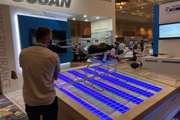
Commercial UAV Expo effervesces in LiDAR and Face to Face gathering

DR. A. STEWART WALKER 09.22.2021

Diversified Communications is the very model of a modern conference company, but even its most experienced managers must have harbored slivers of doubt as they prepared the Commercial UAV Expo Americas, in the Mirage, Las Vegas, on 7-9 September. If we make it, will they come? Will they be so desirous of renewed face-to-face contact that the conference is a sell-out, or will they be unsure, unvaccinated or unmasked, therefore unwilling to risk it?

It turned out to be the former. The event was a huge success and participants reveled in being back together. The raw numbers, provided by DivCom’s genial and extremely knowledgeable event strategist, Carl Berndtson, were: 2767 registrants from 61 nations and all 50 states, 130 exhibitors (the hall included a Korean pavilion for the first time), 12 product launches, 150 speakers and double the projected attendance in the conference sessions. Registration reached 88% of the 2019 figure, way higher than many other conferences that have happened in recent months.

The outdoor demos were a sell-out, with 300 attendees. We were bused to the site near Henderson, Nevada. The shadeless bleachers became brutal as the morning wore on and the temperature rose towards 35°C, but compere Douglas Spotted Eagle of Sundance Media Group and KukerRanken, a regular at these events, repeatedly enjoined attendees to partake of the water provided, so casualties were minimal. We saw UAVs flown in 20-minute slots by Skyfront, CommAris (a brand of Terrafugia, the flying car people), Doosan Mobility Innovation, Skydio, AEE Technology, Autel Robotics, and BRINC/Adorama Business Solutions. This immediately underlined a theme of the conference, the real and increasing role of UAVs in emergency management, first response, and search and rescue. Another very apparent feature was the number of large aircraft, always, however, below the 55 lb limit. Skyfront’s multi-rotor, long-endurance UAV, with a gas engine generating electricity to drive the propellers, can carry a YellowScan lidar, though the large number of available payloads have somewhat of a defense focus. Douglas Spotted Eagle conducted an unscripted show of hands of the audience to see who was using lidar: there were nine responses from the bleachers, five using DJI, one Microdrones and three YellowScan.

Next on was CommAris, the big Seeker long-endurance VTOL requiring two crew with full jumpsuits and helmets to get it airborne. Despite its size (15’ wingspan), the Seeker can be quickly assembled in the field and can carry a 10-lb payload. I spoke to the CommAris folk in the exhibition: so far they don’t have a lidar customer, but they expect several and will keep us informed. As it flew, we saw a hawk (the bird, not the name of another UAV) fly near to take a look, but it elected not to attack. Doosan’s UAV was carrying a USPS package. It uses a hydrogen cell to increase endurance and brought home to us, if we weren’t already believers, that the carrying of packages by UAVs is happening in many countries and is a reality, no longer confined to carrying anti-venom in the remote Amazon, but likely soon to be part of daily life for the non-fluvial Amazon, Walmart and others. Indeed, Walmart’s “director last mile” gave a keynote on Thursday.

IMG 0446 600x400

Doosan Mobility Innovation, indoors at Commercial UAV Expo 2021.

Act five was the public debut of the Mach 6 UAV from AEE, focused on public safety, with dual batteries to increase endurance. Though the payloads shown were not geospatial (thermal imagery of the audience; megaphone; delivery of automated external defibrillator through a partnership with Schiller Medical), the Mach 6 could easily carry lidar. It uses radar for collision avoidance and AEE has BVLOS very much in mind. AEE was followed by another new product, the Skydio X2. The firm has a defense focus and has won an AUVSI Excellence in Innovation award. The demo involved imagery and the creation of a mesh with photogrammetry – no mention of lidar. Like all the presenters, the Skydio team explained aspects of their software using both PowerPoint and live demos on the big screen, though bright sunlight and intense heat sapped audience concentration.

The Autel Dragonfish VTOL is not new, but has evolved considerably from earlier models. The aircraft has a two-hour endurance and offers a terrain-following feature. After the mission, it landed perfectly on the mat provided for it. The audience consisted on UAV veterans, yet this pinpoint ability – which all demos featured – never failed to raise some applause. The last performer was BRINC Drones, a Las Vegas company, assisted by Adorama. Its Lemur S, aimed at the public safety market, uses lidar to help navigation, but not for geospatial purposes. Nevertheless, this remarkable aircraft is worth a few words: if it crashes and tips over, it can get up, right itself and resume the mission; and it was demonstrated with an attachment that can break glass! The latter was used to enter a small hut on the demo site, and we were also shown the UAV flying thermal imagery inside a school bus. Truly remarkable!

IMG 0445 600x400

Commercial UAV Expo 2021 attendees

Thus ended a wonderful morning, impressing upon us the progress being made by UAVs to the extent that they are part of daily life. The efforts of the firms’ personnel, some of whom had been out to the site on one or two previous occasions to rehearse, deserved applause – they had suffered the torrid conditions in order to make our time as productive as possible.

Returning from the desert, we had to prepare quickly for the afternoon fare, the product preview presentations. As always, these were a bit of an endurance test, with 17 15-minute presentations in each of two rooms, necessitating agile jumping between the two in pursuit of the best mix. There were frustrations – ASPRS did not speak at the time advertised on the program, and RIEGL and LiDAR USA were on at the same time – yet the speakers managed to overcome the temptations to firehose us with small detail of their products and the afternoon passed quickly and informatively. There was too much here to report in a few words, but it’s worth following up the geospatial lidar players by looking at their websites for the latest developments, such as DJI, GeoCue, Leica Geosystems, LiDAR USA, RIEGL, SimActive and YellowScan, and imaging players such as AgEagle and Phase One.

After the demanding first day, the event resumed on the Wednesday with opening remarks from DivCom director Lee Corkhill. Top of the bill keynote was Stephen Dickson, FAA Administrator (ex USAF and Delta). He gave a fine presentation, but, as usually happens in these events, once its representative had departed, FAA was targeted with some less than complimentary remarks by later speakers, all of whom are anxious to fly BVLOS, or in the dark, or over populated areas, or all of the above, sooner rather than later. As Stephen said, lots of progress has been made on night flying, but for other desires waivers are the current way to go, so we’re at an inflection point as this process cannot be sustained at scale. Whatever other speakers may have felt, there is no doubt that FAA is busy and one cannot argue with Stephen’s closing remarks, “Safety is a journey, not a destination”, and his emphases on humility and safety.

There was too much in the show to spend time on every booth. Among highlights were, prominent on the DJI booth, an M600 with the Zenmuse L1 lidar sensor. Phase One had a new camera, the P3, complete with gimbal. Emesent had the Hovermap lidar sensor, complete with SLAM software, i.e. it also works in GNSS-denied environments, which can be mounted on UAVs, or land vehicles, or in a backpack of hand-carried – indeed, Emesent perhaps stole the show by showing it on the back of Spot, the robotic dog from Boston Dynamics (remember reading about it in LIDAR Magazine?[1]). Leica Geosystems introduced BLK2FLY, its gorgeous new laser scanner snuggling inside a quadcopter, also called an “autonomous flying laser scanner”. The software is richly furnished with SLAM as well as GNSS/IMU components. Some of the exhibitors gave additional presentations in the theater set up in the exhibition hall, so there was no excuse not to find out about products of interest.

LIDAR Magazine was invited to participate in the “Meet the Press” event. Of the 25 firms who entered, 16 sent representatives to the one-hour live event, at which they spoke for two minutes each, followed by one minute for questions. The speakers entered into the spirit of this “fun” session and fielded the questions both competently and with a sense of humor. The journalists went into purdah and chose Emesent, BRINC Drones and vHive as winners[2].

PXL 20210908 224737409.MP  600x400

Teledyne FLIR spokesperson shares a new sensor with the press.

Amongst all this, I attended as many sessions as possible. Jeremiah Karpowicz of DivCom conducted a good on-stage discussion with Brandon Torres Declet, the new CEO of AgEagle. DivCom favors a formula where part or all of almost every session is a panel discussion, with several experts on stage. Some of these were a tad thin or repetitive, but invariably attorneys, police officers and firefighters did well. These people may not be ideal to discern trends for us after a moment’s thought, but they are performing or managing UAV flights in the thousands every year, so listen up! We’ve moved from shiny toys to commercialization, rapidly and successfully. A session on construction revealed what could be done, for example measuring cranes, flare structures, Las Vegas’s Allegiant Stadium. UAV-delivery firms Zipline and DroneUp both made deep impressions.

Towards the end of the conference, our regular contributor Lewis Graham chaired a session on surveying and mapping. I felt on more familiar ground here as speakers from Ohio UAS Center and The Ohio State University talked about the multiplicity of projects they had completed, while sometimes humorously referring to some of the day-to-day problems they encountered. Also in this session was one of the firms from the Korean pavilion in the exhibition, describing UAV-based geomatics land data acquisition in Ethiopia, using a UAV built in Korea.

ASPRS ran four two-hour workshops, two on Wednesday and two on Thursday, one pair on UAV-photogrammetry and one on UAV-lidar. All were well attended, confirming the thirst for knowledge that was so obvious from the buzz and attendance at this event

The DivCom sales team was energetically working the halls and must have a good chance of following the sell-out exhibition with another one at the Geo Week conferences in Denver in February 2022, where ILMF, AEC Next, SPAR 3D, ASPRS and USIBD will be combined. Meanwhile, LIDAR Magazine was taking every opportunity to solicit firms for articles, as a result of which we are working with DJI, Emesent, LightWare, Phoenix LiDAR Systems, SimActive and several others.

DivCom has decided to change the venue of Commercial UAV Expo Americas and the next iteration of the event will be at Caesars Forum on 6-8 September 2022. LIDAR Magazine would have preferred a slot later in the year, so we would be less well done at the outdoor demos, but won’t hesitate to be there, to learn, enjoy, contribute and be thankful. While the scope of UAVs extends far beyond the geospatial, and the lidar vertical is but a small part of a market dominated by public safety and parcel deliveries, I wouldn’t willingly miss this event. The UAV world is fast moving and more than one company said it was in robotics rather than drones. DivCom’s formula of a technology-based rather than market-based event works and the wide range of backgrounds of attendees is a big plus. I felt almost overwhelmed by information, yet stimulated, inspired and anxious to reflect in order to get it all into perspective. Probably that’s what a successful conference event should inspire!

As I finished this report, HxGN LIVE GeoSummit and Intergeo, remote and hybrid respectively, were swinging into action. Once again, we’re in the thick of development and struggling to assimilate all the news and innovations. It’s a great time to be in lidar!