2025 ISPLS PROMOTION
2025 ISPLS HARDWARE PROMOTION Total Stations | Data Collectors | GPS | Scanners Save on Leica Geosystems Equipment. Acquire gently used, like-new Leica survey equipment through Kuker-Ranken, which has teamed up with Leica Geosystems and Oregon State University’s Geomatics department to enhance student learning. Leica provides OSU with cutting-edge surveying tools for classroom use over […]
Contest Rules
Photo Contest Terms and Conditions 1. Contest Overview This Photo Contest (“Contest”) is hosted by Kuker Ranken (“Organizer”). By participating, entrants agree to abide by the following terms and conditions. 2. Eligibility 3. Contest Period The Contest begins on 1/14/2025 at 12:00 AM and ends on 3/14/2025 at 11:59 PM for the daily prizes and […]
National Surveyors Week Photo Contest
Show Your Surveying Pride! Enter the National Surveyor’s Week, Photo Contest National Surveyor’s Week (March 16-22, 2025) is a time to honor the dedication and skill of professional surveyors who shape our world. This year, we’re inviting surveyors across the nation to share their stories through the lens of a camera. Whether it’s breathtaking landscapes […]
THANK YOU FOR STOPPING BY!
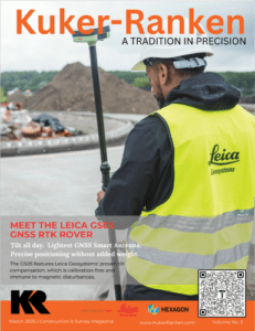
The Leica AP20 AutoPole – Revolutionizing Total Station Measurements Increase productivity and efficiency with Tilt Compensation, which removes the need to level the pole. Easily overcome on-site obstacles by adjusting the height and tilting the pole to reach a hidden point. The Leica AP20 AutoPole is truly a game changer. Enables measurement with a tilted pole. […]
Training Programs with KukerRanken using Pix4D_Leica_drones
KukerRanken Training Brady Reich teaching Pix4D for Construction We are able to train large or small groups KukerRanken offers training in Hardware, Software, and application-specific best practices. KR believes an informed customer is more productive. In addition to our 24/7 support phone/text lines, we offer training for individuals or groups, ensuring cost-effective, optimal workflows for […]
Pix4D for Public Safety Training
Pix4D FOR PUBLIC SAFETY TRAINING Public Safety users of Pix4D benefit from training specifically focused on Public Safety application of the software. Different than generalized training (which misses many of the nuances and processes required for Public Safety users), focused training provides greater confidence and competency when working with Pix4DMapper. Additionally, chain of custody, CJIS-compliance, […]
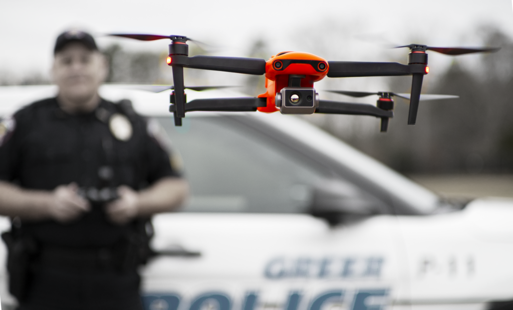
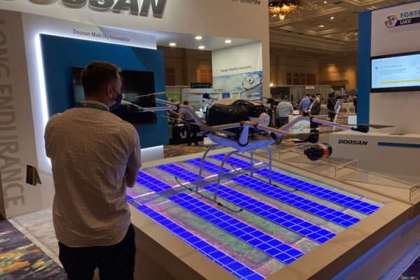
RTK CAPABLE DRONES/UAS for SURVEY, CONSTRUCTION, ENGINEERING
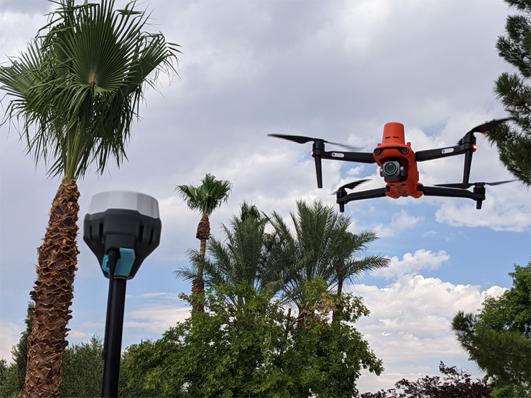
SAVE TIME, GENERATE GREATER REVENUE WITH AERIAL TECHNOLOGY Real-Time Kinematic (RTK) corrections bring significant precision to unmanned aircraft and workflows, even to the point of achieving repeatable precision within 1cm of actual position in a localized dataset. Adding RTK to an unmanned aircraft enables real-time correctional data to be sent to the aircraft, allowing the […]
Viva Las Vegas (LiDAR Excitement)
Commercial UAV Expo effervesces in LiDAR and Face to Face gathering DR. A. STEWART WALKER 09.22.2021 Diversified Communications is the very model of a modern conference company, but even its most experienced managers must have harbored slivers of doubt as they prepared the Commercial UAV Expo Americas, in the Mirage, Las Vegas, on 7-9 September. […]
A Deep Insider’s Look at a Rugged Terrain Mission to Investigate a Helicopter Crash with Drones
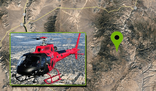
nce that may have not been seen for various reasons during a site walk-through.
LUTS, Log, 10Bit: Geeking Out on Camera Formats for Drones
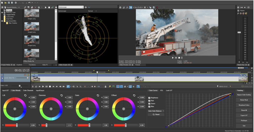
LUTS, Log, 10Bit: Geeking Out on Camera Formats for Drones It takes more than just a Part 107 to be a good drone service provider: customers require expertise in production, too. If you’re confused about camera formats for drones and some of the newest options on the market, we’ve got you covered with this deep […]