


Description
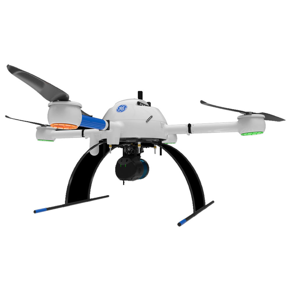
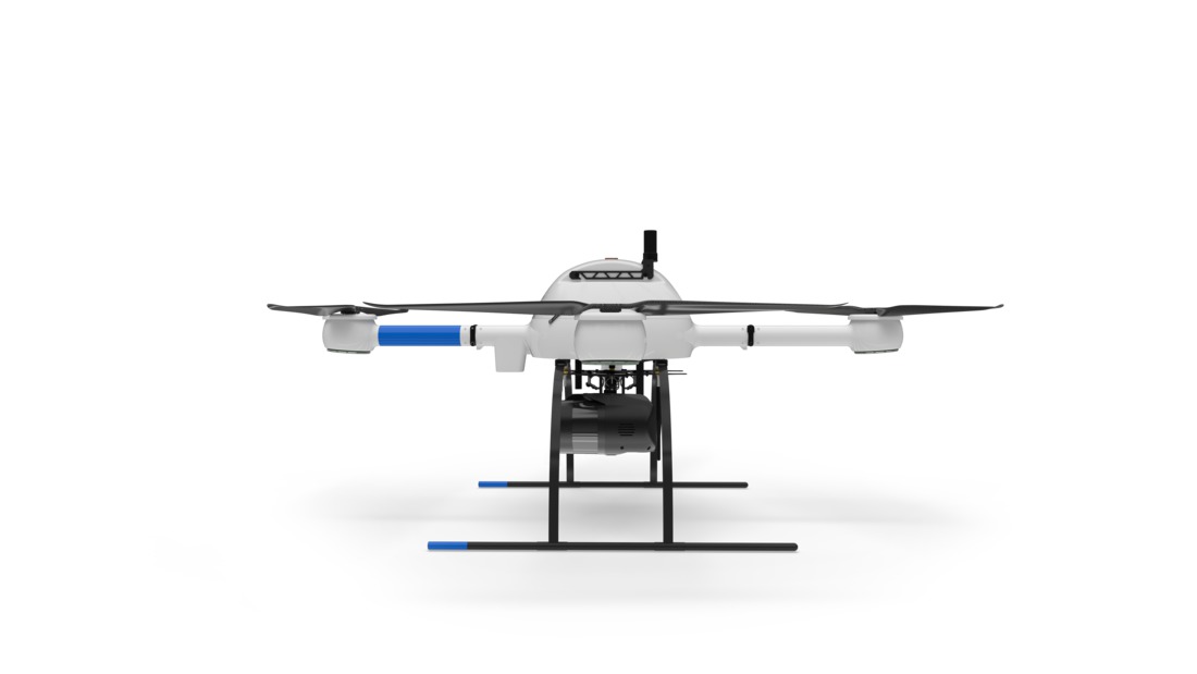
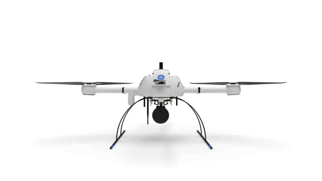
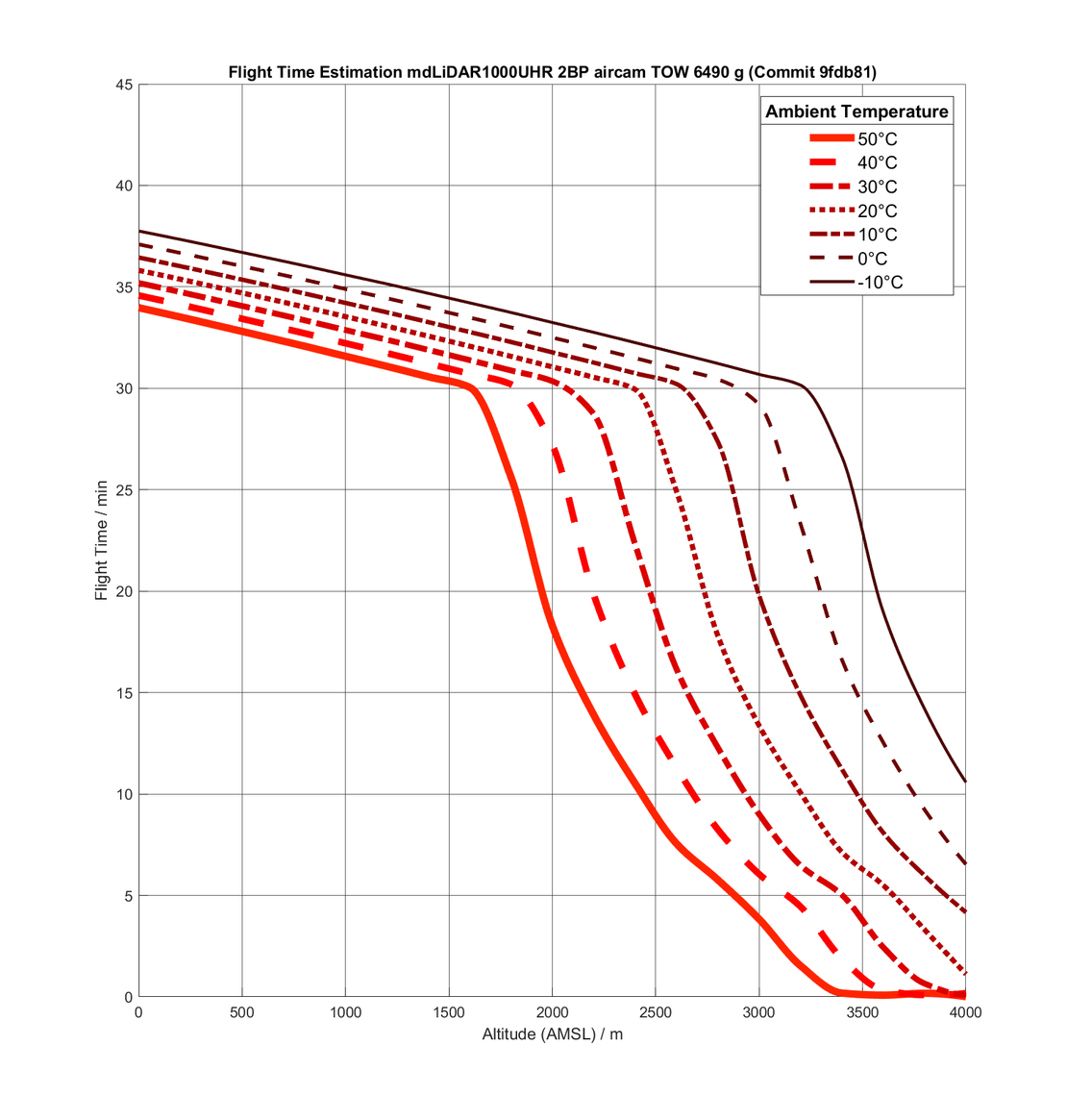
Microdrone mdLiDAR1000 UHR
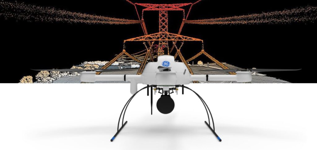
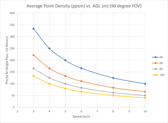
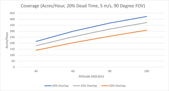
mdLiDAR1000UHR: THE BEST LIDAR POINT DENSITY AND DATA QUALITY EVER OFFERED ON THE MD4-1000 PLATFORM
![]()
mdLiDAR1000UHR means ultra-high resolution via a 32-channel LiDAR sensor, fully integrated with an improved 72.5° field of view camera. This translates to more point density, better detail, and improved deliverables. The survey equipment, LP360 Drone software, workflow, training, and support work together to make you more productive than ever.
Who Should Consider This System:
Professionals responsible for geospatial data collection should consider mdLiDAR1000UHR to support the following tasks.
- Digital twin creation and maintenance
- Corridor mapping
- Mining (volume calculation)
- Construction site monitoring
- Environmental changes (time series)
- Forestry
- Contour mapping
- Planning, leveling, excavation
- Archaeology and cultural heritage
- Highway construction
- Precision agriculture
LiDAR SURVEY EQUIPMENT + LP360 DRONE = EXTREME GEOSPATIAL PRODUCTIVITY, NOW IN ULTRA HIGH RESOLUTION
Microdrones has developed an end-to-end LiDAR solution combining a drone, a LiDAR payload, a fully integrated LiDAR processing and photogrammetry software workflow, and world class support to consistently provide quality deliverables.
mdLiDAR1000UHR and UHR Lite is a fully integrated system for producing 3D pointclouds optimized for land surveying, construction, oil & gas and mining applications.
Improved image acquisition precisely configured to match the laser scanner field of view enables compatibility with streamlined data processing modules within LP360.
Each LiDAR channel of the mdLiDAR1000UHR and UHR Lite is boresight calibrated to improve the data consistency, therefore providing a reduced Standard Measurement Uncertainty.
Improved image acquisition precisely configured to match the laser scanner field of view enables compatibility with streamlined pointcloud colorization and FORMap data processing modules within the mdInfinity platform.


md4-1000
Robust, powerful, stable and dependable. Build your business on this versatile platform, now with 10% increased motor efficiency as part of the Industrial drone line.
Charger & Flight Battery
One md4-1000 flight battery and charger for maximum flight endurance.
Rugged Carrying Case
Bring your Microdrones UAV to tackle missions in the toughest corners of the Earth.
LED Light Rings
Efficient LED light rings provide enhanced visibility in the sky, with configurable color schemes for compliance with your country’s requirements.
Integrated Cooling Covers
Patent Pending motor covers enhance cooling and motor longevity.
Mag-less Navigation
Drone navigation is more robust and less subject to magnetic field interference with no need for magnetometer during flight.
What’s in the box:
PLATFORM
- md4-1000 Robust, powerful, stable and dependable. Build your business on this versatile platform, now with 10% increased motor efficiency as part of the GE Industrial line.
- Charger & Flight Battery One md4-1000 flight battery and charger for maximum flight endurance.
- Rugged Carrying Case Bring your Microdrones UAV to tackle missions in the toughest corners of the Earth.
- LED Light Rings Efficient LED light rings provide enhanced visibility in the sky, with configurable color schemes for compliance with your country’s requirements.
- Integrated Cooling Covers Patent Pending motor covers enhance cooling and motor longevity.
-
Mag-less Navigation Drone navigation is more robust and less subject to magnetic field interference with no need for magnetometer during flight.
COMMUNICATIONS
- Encrypted Digital Data Link. Conveniently command and control your survey equipment using your tablet. Encryption provides additional security for project and plan data.
- mdRC Proven, professional controls and telemetry keep you in control when you need it most, using a second radio link.
- Extended Communication Range Operation Subject to local regulations, select markets within the United States.
- Multiple Tablet Control (Optional, available upon request) Control the drone from multiple tablets. Take off from Point A with Tablet 1, control at Point B with Tablet 2, etc. Helpful for corridor and BVLOS applications
- Remote ID Enabled Broadcast device enabled to comply with unmanned traffic management systems and remote ID requirements.
PAYLOAD
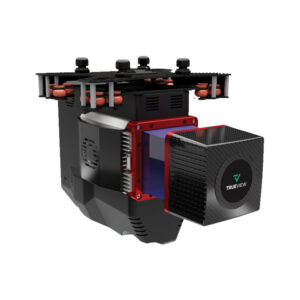
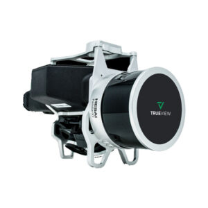
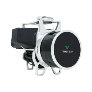
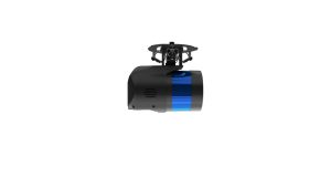
- Fully Integrated High Resolution LiDAR & Camera A lightweight, downward oriented LiDAR solution that efficiently scans up to a 120° field of view.
-
Applanix APX-15 UAV DG Compact single-board module with survey-grade GNSS receiver and a precisely calibrated IMU for mapping.
SURVEY EQUIPMENT SOFTWARE
- mdCockpit Tablet Software Simple swipes of the finger help you plan your survey area, monitor progress, and control your flight on your Android tablet.
- Tap & Fly Easy remote-free tablet flight execution.
DATA PROCESSING SOFTWARE INCLUDED
![]()
LP360 Drone is a powerful ecosystem that will enable you to quickly and efficiently process geospatial data.
Your system will include LP360 Drone, as well as Strip Align and Desktop Photo Add-Ons.
Information / Quote Request
- Click Here for more information or a custom quotation
- Fly your drone professionally – Part 107 Certification Classes


Reviews
There are no reviews yet