


Description
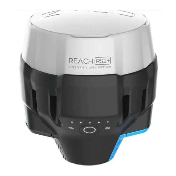
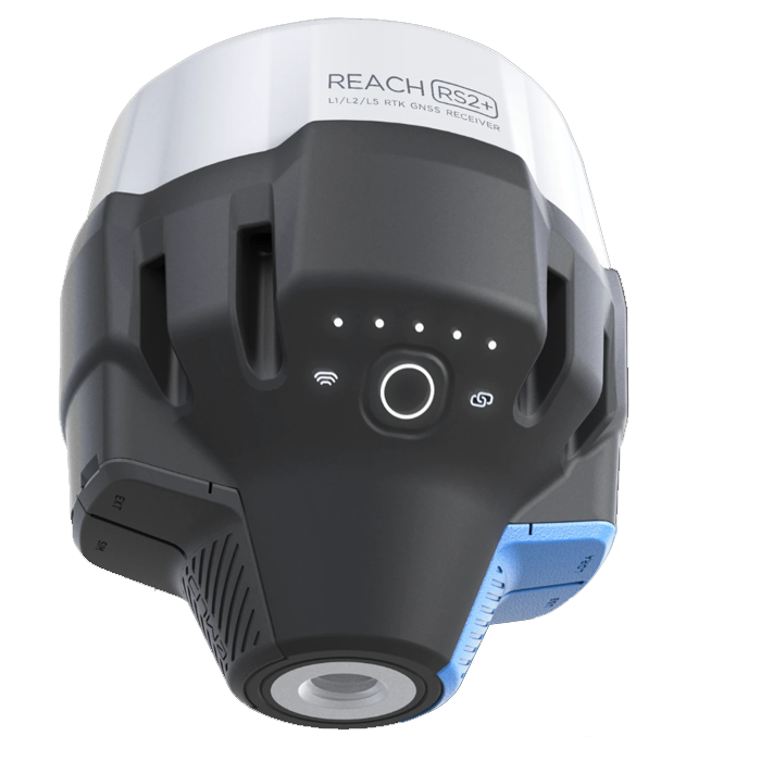
Emlid Reach RS2+ Multi-Band RTK GNSS Receiver with Centimeter Precision
For Drone Surveying, Mapping and Navigation
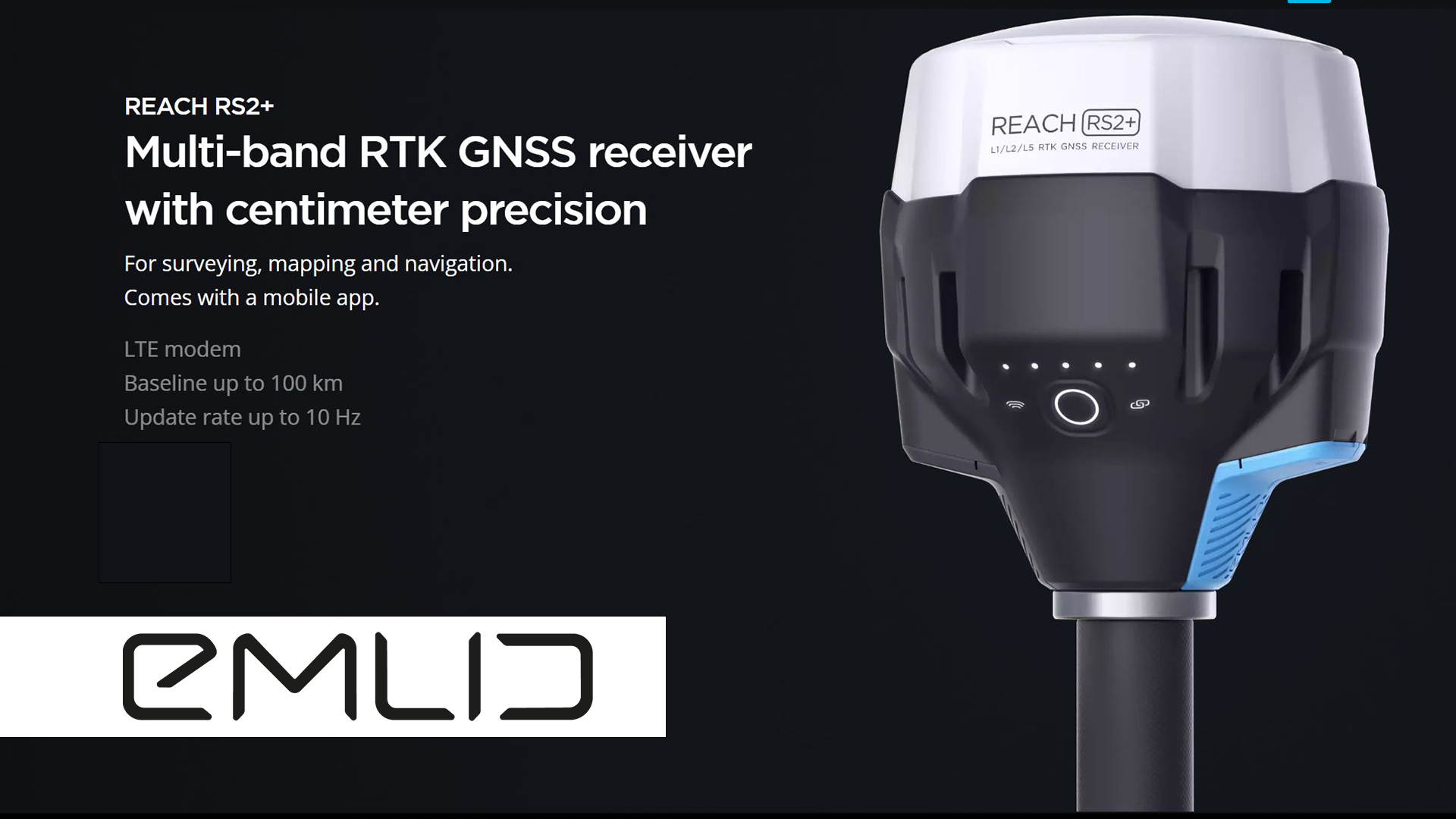
Gets a fix in seconds
Reach RS2+ gets a fixed solution in just seconds and maintains robust performance even in challenging conditions. Centimeter accuracy can be achieved on distances up to 60 km in RTK, and 100 km in PPK mode.
GPS, GLONASS, BeiDou, Galileo, and QZSS
L1OF, L2OF, L1C/A, L2C, E1B/C, E5b, B1I B2I
PPP support
Record raw positioning data in the RINEX format for further post-processing. RINEX logs are compatible with OPUS, AUSPOS, and PPP services, so you can get cm-precise results anywhere on Earth. For post-processing, you can use our free PPK software Emlid Studio.
16 GB storage
160+ days of logging at 1 Hz
Built-in LTE modem
Reach RS2+ features a power-efficient LTE modem with 2G/3G fallback and global coverage. Now corrections can be accessed or broadcasted over NTRIP independently, without relying on an internet connection on your phone.
22 hours on 1 charge
Up to 22 hours of autonomous work when logging data and up to 16 hours as an LTE rover, even in cold weather—no more need to carry spare batteries with you. Reach RS2+ can charge from a USB wall charger or a power bank over USB-C.
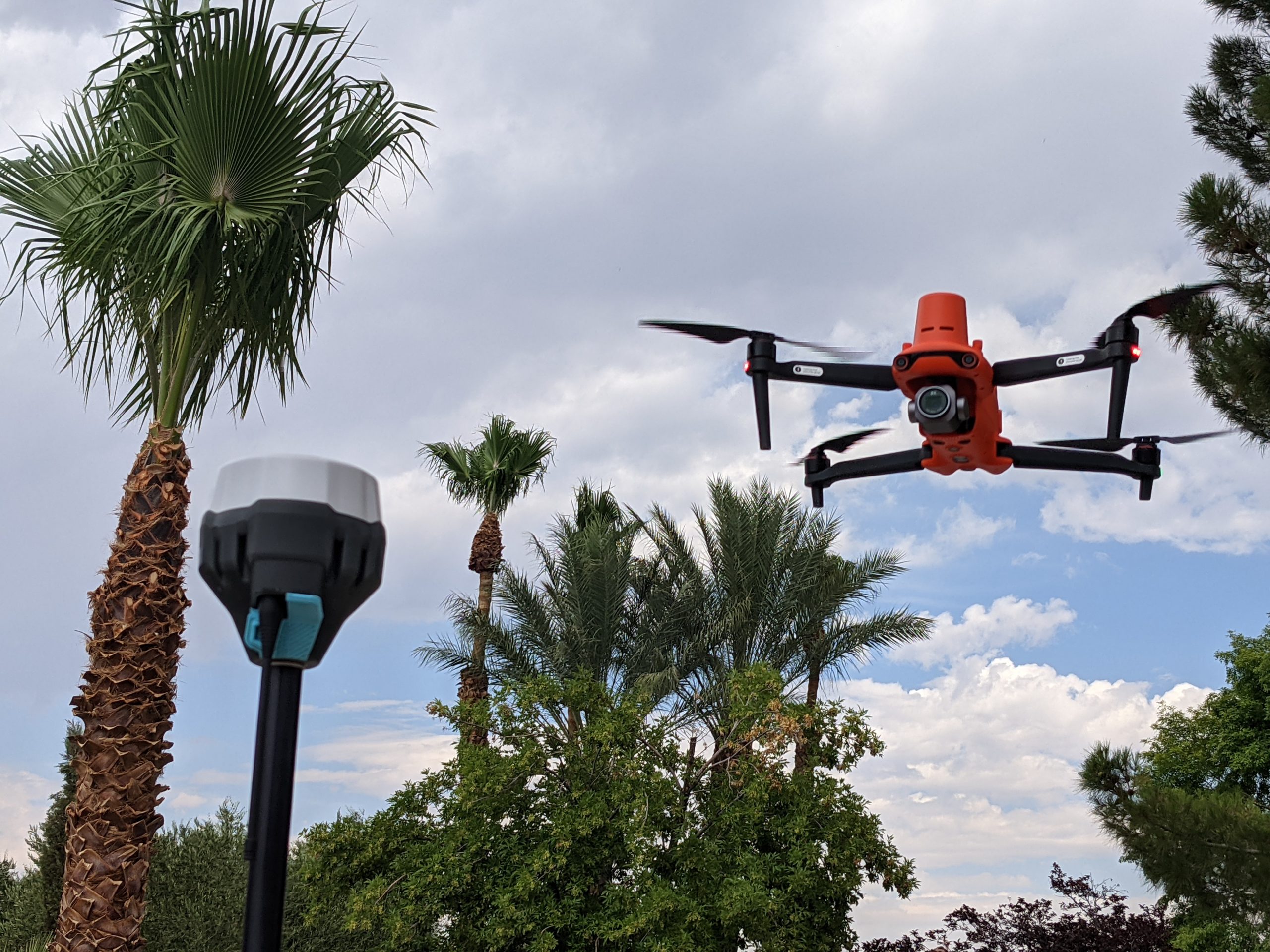
Drone Surveying with ReachView 3
The most user-friendly software for data collection that is available both for Android and iOS. Supports thousands of coordinate systems and is translated into multiple languages. With ReachView 3, you can collect and stake out points and control all the features of Reach receivers, such as setting up a base station, logging RINEX data, and configuring NMEA output.
Point collection:
Save points, and export data to CSV. Record each position as a point with centimeter precise coordinates. Export projects and open them in GIS or CAD software like AutoCAD, ArcGIS, QGIS, and others. Coordinate systems based on WGS84, NAD83, GDA2020, and others
Stakeout:
Find point’s position on the ground. Stakeout is used to find exact physical locations of points. They can be collected in ReachView or imported from other CAD or GIS software.
Logging in RINEX:
record raw data, position, and base correction logs. Record raw data, position and base correction logs. Point collection and recording of RAW data are independent processes and can be used simultaneously. ReachView has a simple and intuitive interface for logging configuration and control.
We provide our version of RTKLib for PPK. It’s free and can be downloaded from our docs.
- 16GB storage
- 160+ days of logging at 1 Hz
PPP for OPUS – RINEX raw data logs are compatible with PPP services so you can now get centimeter-precise results in any place on Earth. Process RINEX files in an online service and get position with absolute accuracy.
NTRIP or another Reach as a base station
Reach RS2+ needs a base station as a source of corrections. That’s a requirement for centimeter precision in RTK and PPK. Base might be either another Reach RS2+ receiver or an NTRIP service. VRS is also supported. Reach RS2+ works seamlessly with other Reach receivers over any link.
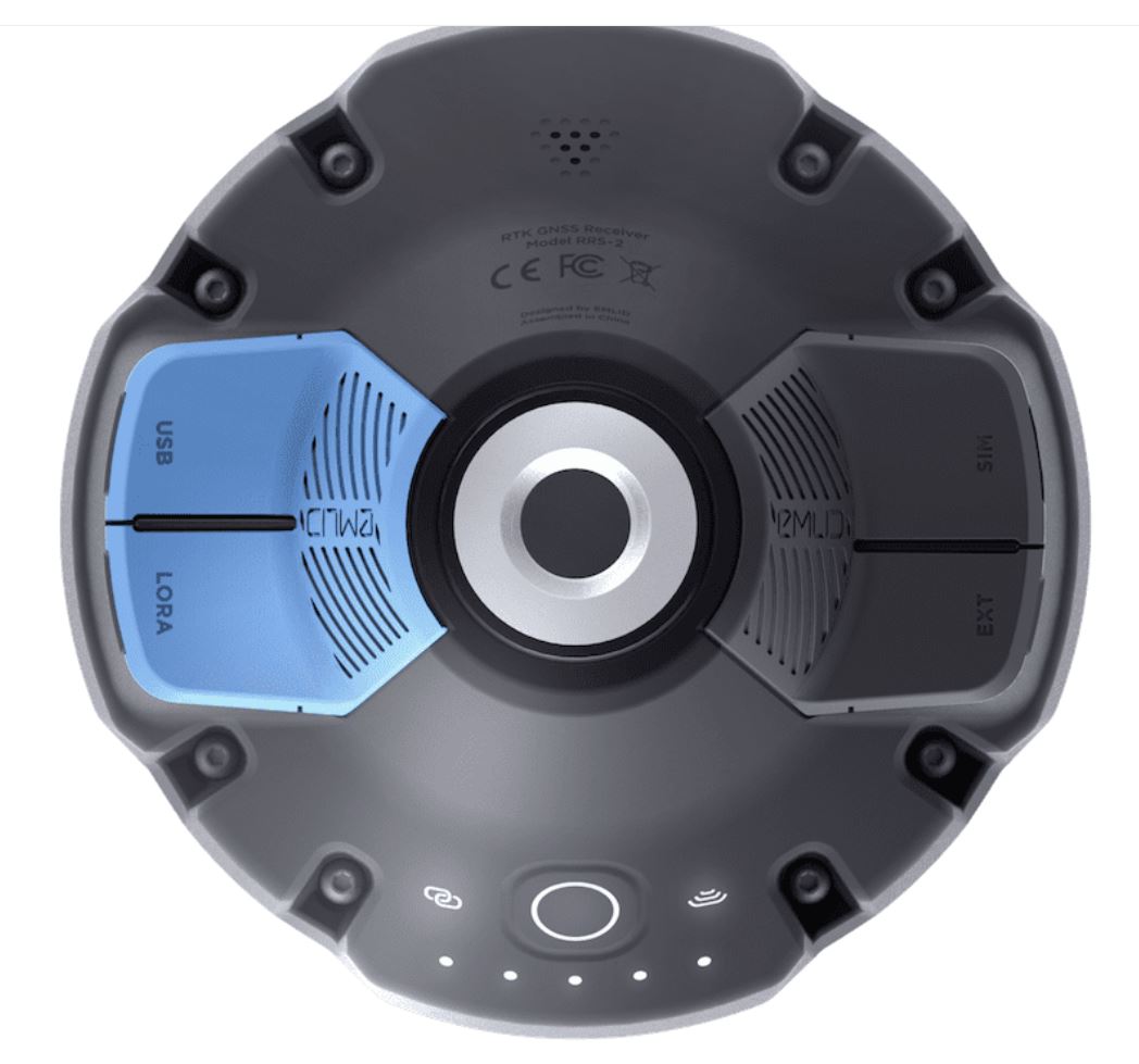
Input and output corrections
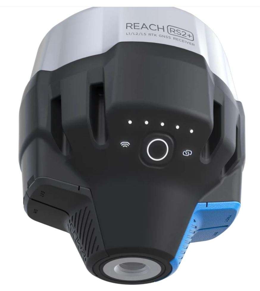
Interfaces: TCP, LoRa, Bluetooth, RS-232, NTRIP
Formats: RTCM3
Max distance from a base
- Over 60 km in RTK
- 100 km in PPK
- Any place on Earth with PPP
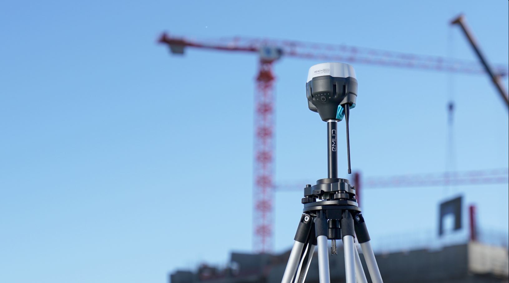
Engineered to be tough – Reach RS2+ is designed to work even in the most challenging environments.
IP67 RS2 is waterproof up to 1 m depth. All connectors are completely sealed and protected from water and dust with silicone plugs.
-20ºС…+65ºС We extensively tested Reach RS2+ in conditions that simulate coldest winters and hottest summers.
Polycarbonate body Polycarbonate, an extremely durable material that is used in bulletproof glass, makes Reach RS2+ impact-resistant.
Covered with elastomer This is a rubber-like material that forms a shock absorber around the whole device. In a sophisticated manufacturing process, elastomer is permanently bonded to the polycarboante base so that if your bipod falls over, Reach RS2+ will bump off, no marks left.
Rugged 5/8″ mount
A precision CNC machined threaded mount is inserted during the molding process and becomes one with the plastic. The metal mount works as a heatsink, transferring heat away from the electronic components and ensuring stable operation in a hot climate.
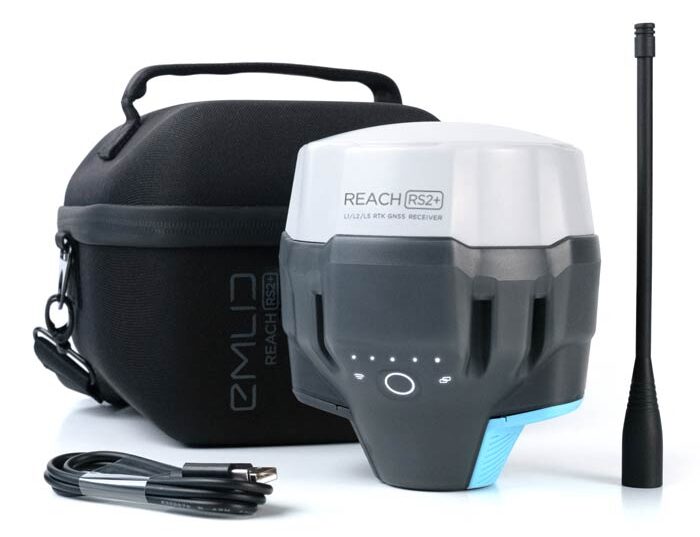
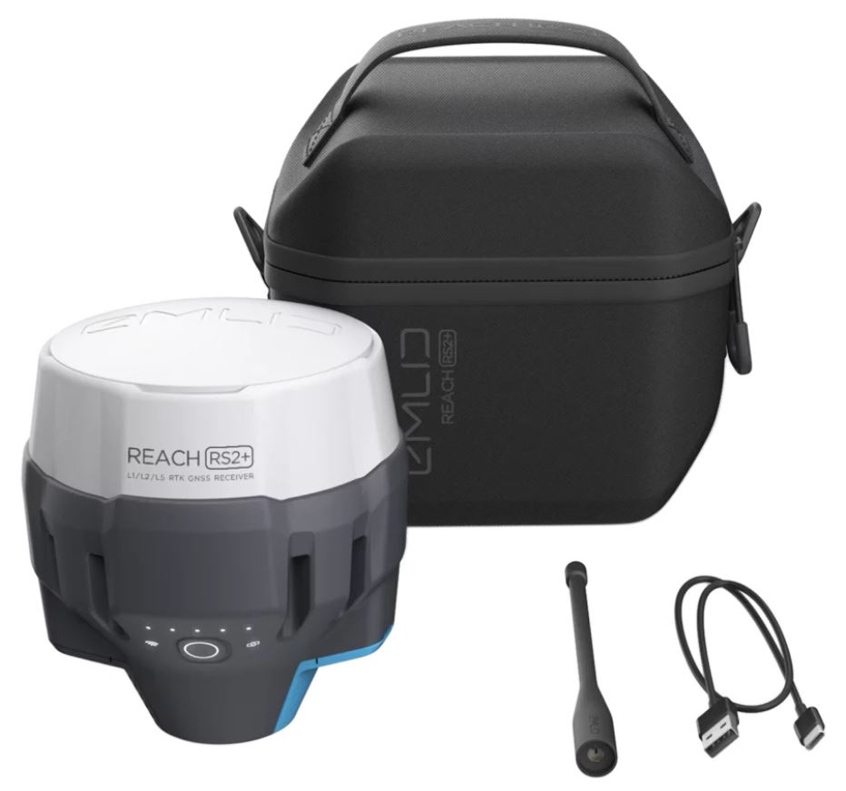
Comes with LoRa antenna, USB cable, and carry case with a strap
What’s in the box
- 1x Emlid REACH RS2+ GNSS Receiver
- 1x Radio Antenna
- 1x Pole Adapter
- 1x Heavy Duty Soft Cary bag
- 1x USB to USB-C cable
- 1x Phone App Software
Reviews
There are no reviews yet