
Description
Leica Cyclone REGISTER 360 PLUS – BLK Edition (1 year subscription)
Speed, Scale, Simplicity
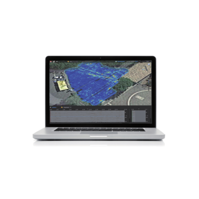
Cyclone REGISTER 360 PLUS (BLK Edition) is the first step in preparing your BLK reality capture data for delivery to clients or use downstream in design packages. Accurate registration is a must for any successful reality capture project and this simple and powerful tool allows you to quickly register your scans, clean your point cloud and produce all Leica Geosystems native and industry-standard formats.
1 year subscription to Cyclone REGISTER 360 PLUS – BLK Edition
Key Features
- Simple guided workflow: Import, Review and Optimize, Finalize and Publish
- Optimized for projects up to 500 scans
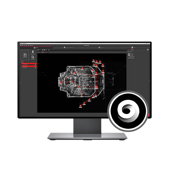
- Visual QA lets you clearly see the quality and alignment of your project
- Support for all Leica Geosystems BLK scanners plus third party and industry standard data formats
- Publish to Leica Geosystems downstream products, the universal reality capture project file (LGSx)* and ReCap files (RCP), and all industry standard formats
- For a complete listing of product features please reference the Cyclone Technical Specification
- Cyclone REGISTER 360 PLUS (BLK Edition) includes publishing to ReCap
- Cyclone REGISTER 360 PLUS (BLK Edition) supports BLK360, BLK2GO, BLK2FLY, BLK ARC and BLK2GO PULSE data from the scanner, .blk or .b2g files or Cyclone FIELD 360
The Power of Cyclone, simplified.

Leica Cyclone REGISTER 360 PLUS (BLK Edition) borrows from the simplicity of the BLK360 and BLK2GO while maintaining scalability to deliver a simple and robust point cloud registration solution.
Cyclone REGISTER 360 PLUS (BLK Edition) empowers users of any skill level to work smarter, deliver results more accurately, visualize in more detail and collaborate more effectively – placing the user at the center of their project.
Speed
Drag, Drop, Done. From project creation to final reporting, project completion is significantly faster thanks to multithreaded batch routines, one-step import and processing, guided workflows, built-in QA/QC tools and automated reporting to save significant time and guess-work while delivering higher productivity
Scale
Cyclone REGISTER 360 PLUS (BLK Edition) handles even the most challenging of projects with ease and takes the headache out of complex workflows. New users can execute large projects, scaling to your needs, thanks to the simple-yet-powerful interface.
Simplicity
Deliver professional-level project deliverables with ease. Cyclone REGISTER 360 PLUS (BLK Edition) provides guided registration workflows to assist new users and speed the process for experienced users. Intuitive QA tools and reporting take the guesswork out of your registration quality and put all the information you need at your fingertips. Batch export your final products to a range of formats and programs and even push live data to the cloud for global collaboration with the click of a button. Cyclone REGISTER 360 PLUS (BLK Edition) now supports publishing of Leica Geosystems universal digital reality file, the LGSx file, for simple downstream use in CloudWorx and Leica Cyclone 3DR.