


Description
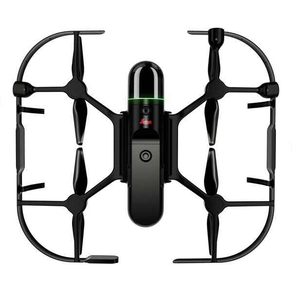
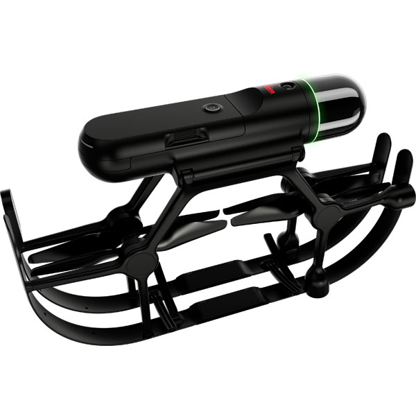
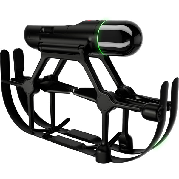
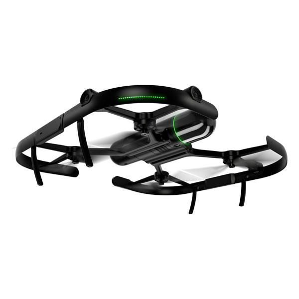
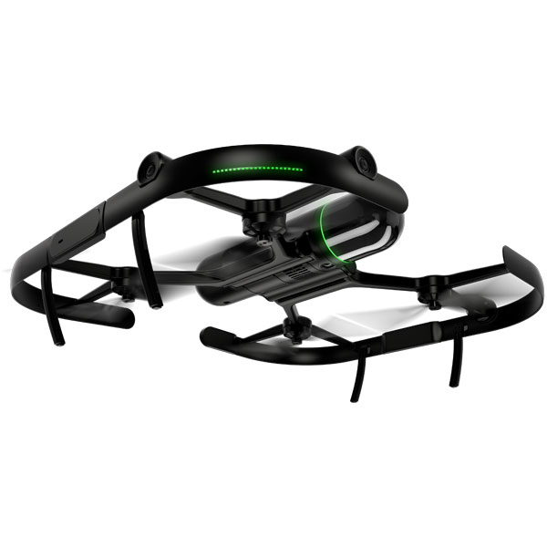
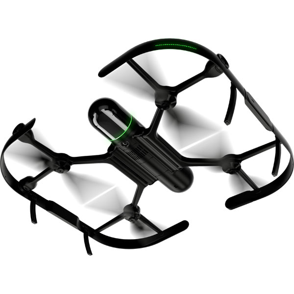
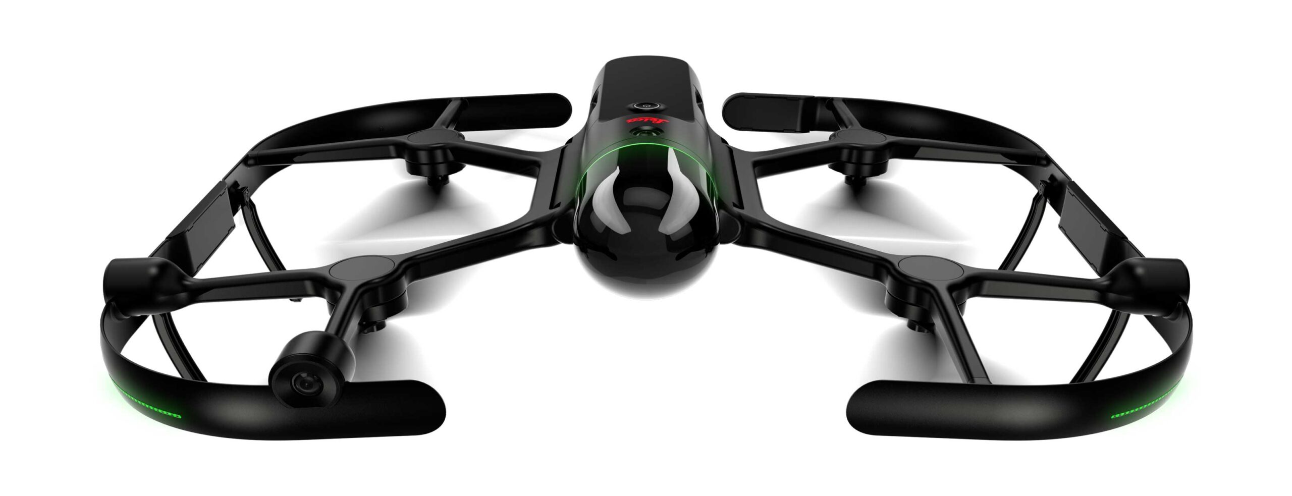
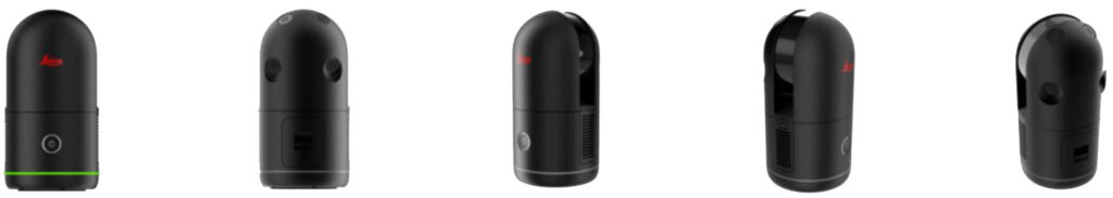
Leica BLK2FLY Autonomous Flying Laser Scanner
Handheld, wireless and lightweight, designed for fast reality capture on the move.
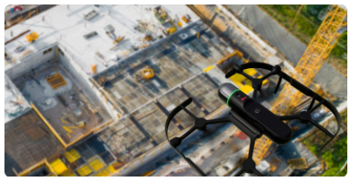
BLK2FLY captures building exteriors, structures, and environments to create 3D point clouds while flying.
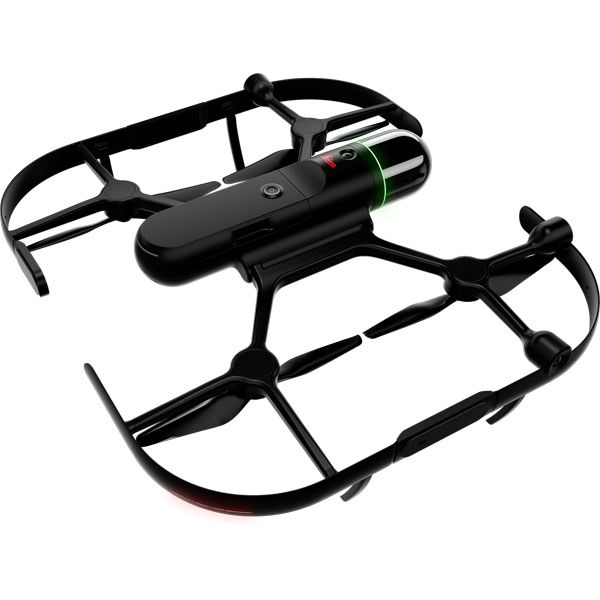
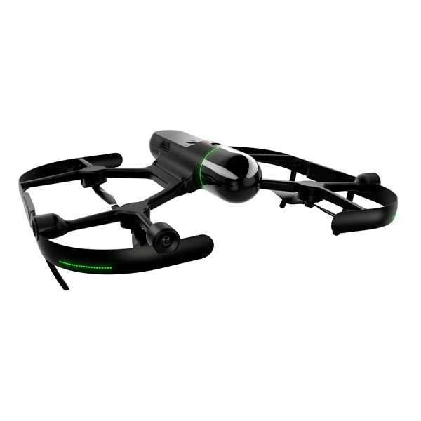
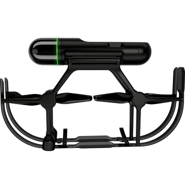
BLK2FLY is the world’s first fully integrated LiDAR UAV. It is an autonomous flying laser scanner with advanced obstacle avoidance for easy reality capture from the sky. Easily scan an entire building. BLK2FLY captures colorized 3D point clouds for producing 3D models, drawings, and visualizations.
Scan inaccessible areas like rooftops and facades. BLK2FLY autonomously captures exterior features and dimensions of buildings with a few taps on a tablet. Next generation flight safety technology. Simply tell the BLK2FLY where to go and watch it navigate itself safely around obstacles to capture an accurate, uniform scan.
You set the mission and BLK2FLY does the rest. The BLK2FLY is as simple to use as possible. Define your scanning area, press a button, and you’re clear for takeoff.


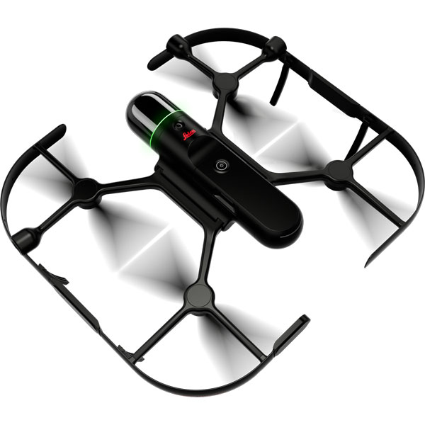
Advanced Obstacle Avoidance
The BLK2FLY uses advanced omnidirectional radar and LiDAR sensors to avoid obstacles, safely capturing acccurate and uniform scans.
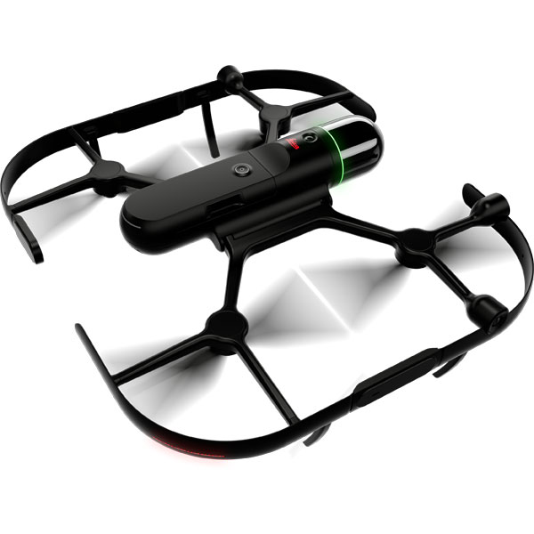
Autonomous UAV Scanning
The BLK2FLY intelligently identifies the environment around it for its flight plans, keeps the correct distance for ideal scanning, and formulates optimized flight routes.
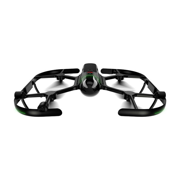
Indoor Scanning
The BLK2FLY’s indoor scanning mode allows for complete scans of interiors, getting closer to objects, and flying in tight spaces. Combine indoor and outdoor scan date to create a comprehensive model of anything you capture, inside and out.
The BLK2FLY is the easiest and fastest way to scan indoor and outdoor areas that require a UAV. With powerful autonomous technology, the BLK2FLY is easy to use with simplified operation. Unfold the scanner, set it on the ground or floor, fire up your iPad, turn on the BLK2FLY with the push of one button, and you’re ready for takeoff. It is fully compatible with the Leica Geosystems Cyclone suite of Reality Capture software as well as Reality Cloud Studio, powered by HxDR, offers unprecedented scanning agility to reality capture users in industries worldwide.
With a 5-camera vision system and a dual-axis LiDAR scanner that captures 420,000 measurement points per second, the BLK2FLY is ready to take on any project. Fully integrated sensors – radar, LiDAR, cameras, and GNSS – enable advanced obstacle avoidance and heightened spatial awareness to ensure the BLK2FLY always flies safely and takes the most optimal flight path to capture data evenly and quickly. Simply transfer data with USB-C or WLAN connectivity.
Leica Cyclone REGISTER 360 PLUS (BLK Edition) Subscription
Leica Cyclone REGISTER 360 PLUS (BLK Edition) is a simplified version of Leica Geosystems Cyclone REGISTER 360 PLUS that features an intuitive UI, guided workflows and an easy process for sharing data downstream with more advanced tools like Cyclone 3DR and CloudWorx. Or export your point clouds as a standard E57 file or Autodesk’s native RCP file format. Cyclone REGISTER 360 PLUS (BLK Edition) is optimized for the BLK2FLY and provides streamlined workflows to assist new users and speed up the process for experienced users.
Reality Cloud Studio, powered by HxDR
Reality Cloud Studio is Hexagon’s cloud-based application for reality capture data storage, automated meshing and registration, advanced visualization, and up-to-the-minute collaboration. Simply upload your BLK2FLY data directly from the scanner using Reality Cloud Studio’s browser-based UI and work with your data immediately in the field.
Software options for every kind of project
For larger projects or existing Cyclone users, Leica Geosystems Cyclone REGISTER 360 PLUS and Cyclone FIELD 360 are also available to help register your scans together and view scan data and imagery in real-time.
Details
- Carbon and glass fiber frame housing
- 256GB Internal Storage
- 13 min Flight Time
- Field of view 360° (vertical)/270° (horizontal)
- Scan range Min. 0.5 m – up to 25 m
- Point measurement rate 420,000 pts/sec
- Vision system 5-camera system, 1.6 MP, 300° x 180° total, global shutter
In The Box
- Leica BLK2FLY Flying Laser Scanner
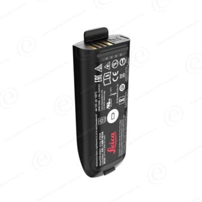
- GEB374 BLK2FLY Smart Battery
- GKL352 BLK2FLY Single Battery Charger
- GEV288 USB-C Cable, 1.5m
- Leica BLK2FLY Propellers CW & CCW
- Cleaning Cloth
- Quick Guide


 [su_button url=”https://www.eventbrite.com/cc/kukerranken-roadshow-2022-815729″ background=”#2defd4″ color=”#000000″ size=”4″ center=”yes”]More Information[/su_button]


Reviews
There are no reviews yet.