


Description
PIX4Dsurvey
Bridge the gap between photogrammetry and CAD

Capture images or point clouds with a drone or any laser scanner.
When using a drone, automate and optimize your flights with the free PIX4Dcapture mobile app.
Import
Import data from other Pix4D software or a .las or .laz file to PIX4Dsurvey and combine multiple datasets into the same project.
Work with both imagery data and LiDAR point clouds.
Vectorize
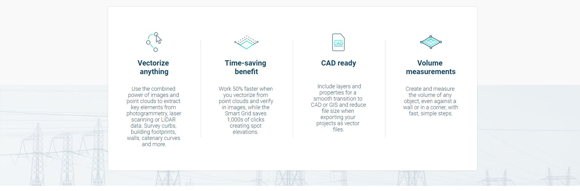
Generate a TIN to model the ground and create engineering-ready CAD vector files from point cloud data by extracting key elements of your project with PIX4Dsurvey.
Model
Move from a lightweight point cloud to a model of your terrain. Use the Smart Grid, TIN, and terrain classification to get accurate, actionable results
Integrate
Open your simplified, accurate data in any CAD or GIS software with custom layers and properties that fit your existing workflow.
Beyond the point
Extract only the most relevant information to speed up and simplify your surveying workflows
Your choice of point cloud
Import projects from PIX4Dcloud, PIX4Dmatic, PIX4Dmapper or any .las or .laz file.
 Create a point cloud from images in PIX4Dcloud, PIX4Dmapper or PIX4Dmatic, and drag and drop the .p4d or .p4m file to PIX4Dsurvey.
 PIX4Dsurvey works with multiple point clouds at the same time formatted as an .las or .laz file.
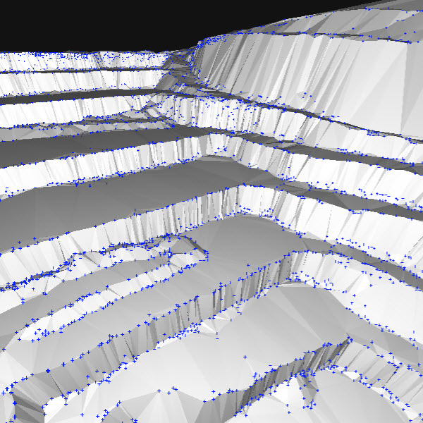
From point cloud to TIN in a fraction of the time
Automate the creation of spot elevations and allow drastic simplification of the number of point cloud points. With a click, use this Grid of points to model the ground with a TIN.
Extract the same points you would use in the field with Smart Grid – it doesn’t create any data, but instead reads the terrain class for locations of elevation change, just like your field crew would take spot elevations along breaklines.
Next up? Take that set of points & breaklines and create a DTM in LandXML format that exactly reflects the points you have told it to use. Now you are good to go in your CAD or GIS!


Reviews
There are no reviews yet