



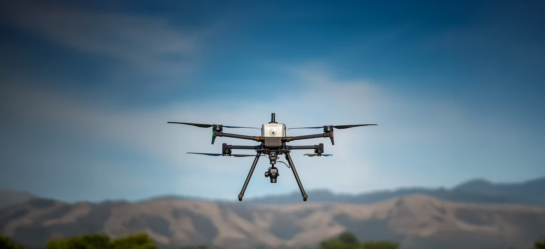
The IF800 TOMCAT is a cutting-edge drone designed for tough environments, offering superior performance and compliance, making it a strong competitor to DJI’s M300. Its advanced technology and focus on national security position it as the preferred choice for commercial and government use. As a certified Blue UAS by the DIU, it guarantees top-tier data protection and operational efficiency, solidifying its status as the industry’s most trusted solution.


One aircraft. Multiple missions. The IF800 integrates with a wide range of industry-leading sensors, allowing teams to adapt quickly as project requirements change.
Optical Cameras
High-Resolution Mapping & Inspection
High-resolution imaging for mapping, inspection, and documentation.
Multispectral Sensors
Agriculture & Environmental Analysis
Actionable data for agriculture, environmental monitoring, and research.
LiDAR
3D Mapping & Terrain Modeling
Accurate terrain and structure modeling across complex environments.
EO/IR Cameras
Thermal Inspection & Search-and-Rescue
Thermal and visual insight for inspection and situational awareness.
Geophysical & Specialized Sensors
Subsurface & Utility Inspection
Support for custom and emerging payloads tailored to unique missions.
Configuration options matched to your workflow
Kuker-Ranken Reality Capture and Drone Instructor Francisco Gonzales C.M.S. had a highly successful first day of training and flight operations with the new Inspired Flight IF800, marking an exciting milestone for the Washington State entity. The team began their drone journey by familiarizing themselves with smaller, more manageable models from Autel and DJI, gaining valuable hands-on experience and confidence before advancing to the powerful IF800. Once comfortable, they quickly transitioned to the larger, more sophisticated drone, successfully getting the bird in the air and demonstrating the device’s capabilities. This initial success not only underscores the effectiveness of their training program but also highlights their readiness to deploy advanced drone technology for a variety of professional applications, paving the way for future projects and operational excellence in reality capture and aerial surveying.
The setup process for the Inspired Flight IF800 was quick and straightforward, allowing for efficient deployment. As the users took control, Francisco Gonzales C.M.S. closely monitored their progress, offering helpful hints and expert guidance throughout each step to ensure proper assembly and safe operation. His hands-on approach not only facilitated a smooth setup but also provided valuable learning opportunities for the users, enhancing their confidence and understanding of the drone’s features and handling. This collaborative effort underscored the effectiveness of the training session, setting a solid foundation for future drone operations and applications.
Engineered for real-world use. Built to meet the demands of professional operators across survey, inspection, and research applications.
Specification | Metric Value | Imperial Value |
|---|---|---|
Max Ascent Speed | 5m/s | 16 ft/s |
Max Descent Speed | 3m/s | 10 ft/s |
Max Air Speed | 22m/s | 49 mph |
Max Wind Resistance | 10m/s, 12m/s gusts | 19 knot, 23 knot gusts |
Max Tilt Angle | 30° | 30° |
Max Angular Velocity | Tilt: 300%, Yaw: 120% | Tilt: 300%, Yaw: 120% |
Operating Temperature | -20°C ~45°C | -4°F ~113°F |
Service Ceiling (with given payload) | 4.2km (14,000 ft) w/0.0 kg, | 14,000 ft w/ 0.0lb, |
3.2 km (10,500 ft) w/ 1.5 kg, | 10,500 ft w/ 3.3lb, | |
2.0 k m (6,500 ft) w / 3.0 kg | 6,500 ft w/ 6.6lb |
Specification | Metric Value | Imperial Value |
|---|---|---|
Diagonal Size (propeller center to center) | 905 mm | 35.6 inches |
Unfolded Size (flight ready, WxLxH) | 132 x 114 x 52 cm | 51.8 x 44.8 x 20.3 inches |
Folded Size (stow, WxLxH) | 36 x 44 x 20 cm | 14.2 x 17.4 x 7.8 inches |
Empty Weight (w/o batteries) | 4.2 kg | 9.2 lbs |
Weight w/ Batteries | 8.5 kg | 18.7 lbs |
Max Gross Takeoff Weight | 11.5 kg | 25.3 lbs |
Max Payload Capacity | 3.0 kg | 6.6 lbs |
Transport Case Size (WxLxH) | 52.8 x 80.7 x 31.7 cm | 20.8 x 31.8 x 12.5 inches |
Transport Case Weight (w/ aircraft & GCS) | 18 kg | 40 lbs |
Component | Specification |
|---|---|
Flight Controller | CubePilot Cube Blue H7, Triple Redundant IMU |
GNSS / Compass | Dual CubePilot Here4 |
Downward Ground Sensor | LightWare SF000/B |
Payload Power Rails | 12 volts at 2 amps |
Payload Interface | Pixhawk Payload Bus Standard |
Operating Software | ArduPilot Copter QUAD V |
Flight Mode | Description |
|---|---|
Position Hold | Maintains GPS position and altitude with responsive controls for faster speeds. |
Loiter | Holds GPS position and altitude for slow, precise, and stable flying. |
Auto | Executes pre-defined waypoint mission |
RTL | Auto returns to takeoff location and lands |
Land | Auto land while maintaining horizontal position |
Altitude Hold | Holds altitude only, failsafe mode if GPS signal lost |
In the Box (base model):
Additional models available upon request
Join the Kuker Ranken Robotics team as we travel the Western USA. Live flight, software demonstrations, tour through our mobile command/mobile shack, presentations on UAS best practices and safety tips, and goodie bags await all who attend! Don’t MISS OUT!
The New Leica BLK360 3D Imaging Laser Scanner. Now Smaller and Faster than ever!
A supercharged next-gen imaging laser scanner, the NEW BLK360 captures a full scan with spherical images in only twenty seconds—over five times faster than the BLK360 G1.
LiDAR sensor captures 680,000 points per second | 20% smaller than the Leica BLK360 G1 | Rapid data transfer with USB-C
[su_button url=”https://kukerranken.com/product/leica-blk360-g2-3d-imaging-laser-scanner-951110/” background=”#ef302d” color=”#ffffff” size=”4″ center=”yes”]More Leica BLK360 Information[/su_button]
Shipping Begins June 28th, 2022

Benefit from the quality, precision and reliability of Leica Geosystems Original Accessories – perfectly suited for Leica Geosystems measuring equipment.

Leica Geosystems Original Accessories now come with unique security codes that guarantee that what you bought is truly a part of the Leica Geosystems complete solution. No other accessories compare to those developed and produced by Leica Geosystems.
Genuine Leica Geosystems Accessories

Leica Geosystems Original Accessories now come with unique security codes that guarantee that what you bought is truly a part of the Leica Geosystems complete solution. No other accessories compare to those developed and produced by Leica Geosystems.
Genuine Leica Geosystem Accessories


Learn the rules and requirements to fly your drone in accordance with the FAA’s Small UAS Rule (Part 107). This certification demonstrates that you understand the regulations, operating requirements, and procedures for safely flying drones.

Class runs from 8AM – 4PM PDT
Thursday, April 14 & Friday, April 15 2022
Thursday, May 19 & Friday, May 20
Thursday, June 16 & Friday, June 17
Thursday, July 14 & Friday, July 15
Thursday, August 18 & Friday, August 19
You can see how this popup was set up in our step-by-step guide: https://wppopupmaker.com/guides/auto-opening-announcement-popups/