MEET THE ANYbotics ANYmal!
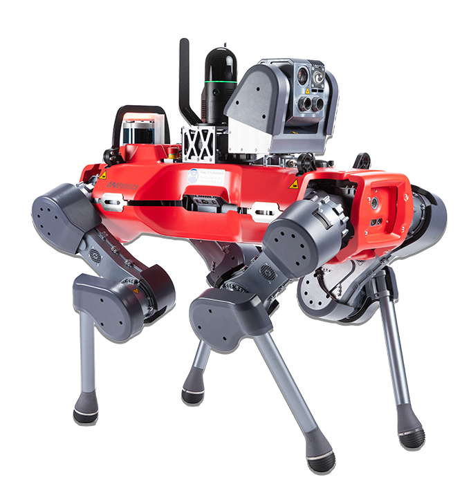
ANYmal is the ultimate UGV (Uncrewed Ground Vehicle) and KukerRanken is the first dealer in the USA with this amazing product.
AEC, Public Safety, Surveyors, and Inspection professionals all benefit from AI-powered ANYmal.
This technology does not require an operator (all other UGV require an operator at this time), and with it’s IP67 rating, can manage any environment regardless of how wet or rugged the operations area may be.
KukerRanken offers the ANYMal with the Leica BLK ARC sensor system, or without.
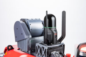
The ARC adds high end mobile scanning to the system, with mobile mapping. Alternatively, other HDS scanners may also be mounted for static scanning.
ANYmal by ANYbotics is NDAA compliant. The ANYbotics statement of compliance may be downloaded for print.
WHAT MAKES ANYmal so different?
ANYmal is unique in being a machine learning-based system vs competitors being model-based systems. ANYmal is capable of on-the-fly decisions, enabling the ANYmal to operate in environments where other systems may fail.
Additionally, the ANYmal is a complete “commercial off the shelf” solution. Competitors are platform systems, meaning the user buys the UGV, and then works with third-parties to create the useable solution. ANYmal, as offered by KukerRanken, is capable of scanning, searching, inspecting, measuring, or modeling data within minutes after purchase.
The ANYmal may be operated by an operator, or set up for automated inspections with no operator input. ANYmal may also be controlled from remote environments anywhere in the world, enabling ANYmal to be a true robotic responder, inspector, or BIM tool without human input.
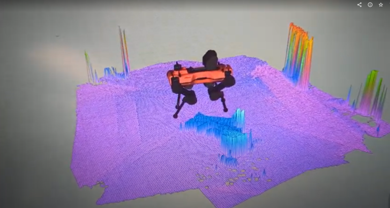

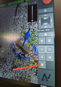
ANYmal creates and understands the environment through both LiDAR and Depth Cameras. In the image to the left, Depth Cameras are used to “map” and be aware of obstacles/potential obstacles in the environment. ANYmal even has modes where it can “test” the height of an object to determine if it should step over, or go around the obstacle.
The Depth Cameras may be used to identify April tags on the ground, whether for inspection points or for the docking station. April tags are used by the ANYmal to identify its docking (charging) station, and auto-dock for automated charging.
Seen on the left, LiDAR is also used to “map” and understand the environment. This enables the ANYmal to confidently operate in virtually any environment without concern for obstacle interference or challenges in terrain, rough rocky hills, rubble piles, or other difficult environments where other UGV are unable to operate.
ANYmal’s integration with other sensors provides the greatest flexibility available in any scenario. Integration allows users to control third-party sensors with the ANYmal remote, software application, or in fully-automated, operator-less modes.
Imagine for example, being able to plan, execute, and deliver a UGV mission without leaving the office, with the UGV being on another continent!
Currently, only ANYmal is capable of this sort of operation.
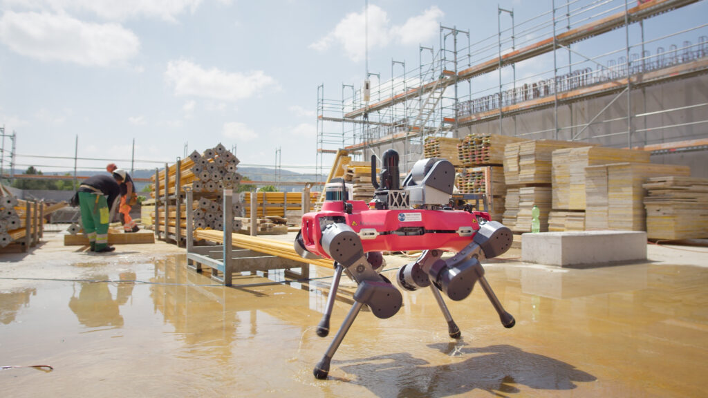
HBC Remote, computer driven, tablet, mobile phone, or automated operation, the ANYmal is vastly superior to any other solution in build quality, intelligence, payload selection, endurance, ability to operate in rugged or harsh environments, and user-friendly operation.
With standard thermal camera, RGB camera, zoom camera, LiDAR, and other sensors built into the ANYmal, users always know where the UGV is operating, what it’s sensing, observing, and moving towards. Integration for additional payloads is available for virtually any type of environmental requirement, including optional gas detectors, and other tools.
In a Machine before Human scenario, ANYmal is the only choice where reliability, confidence, and success are mission requirements.
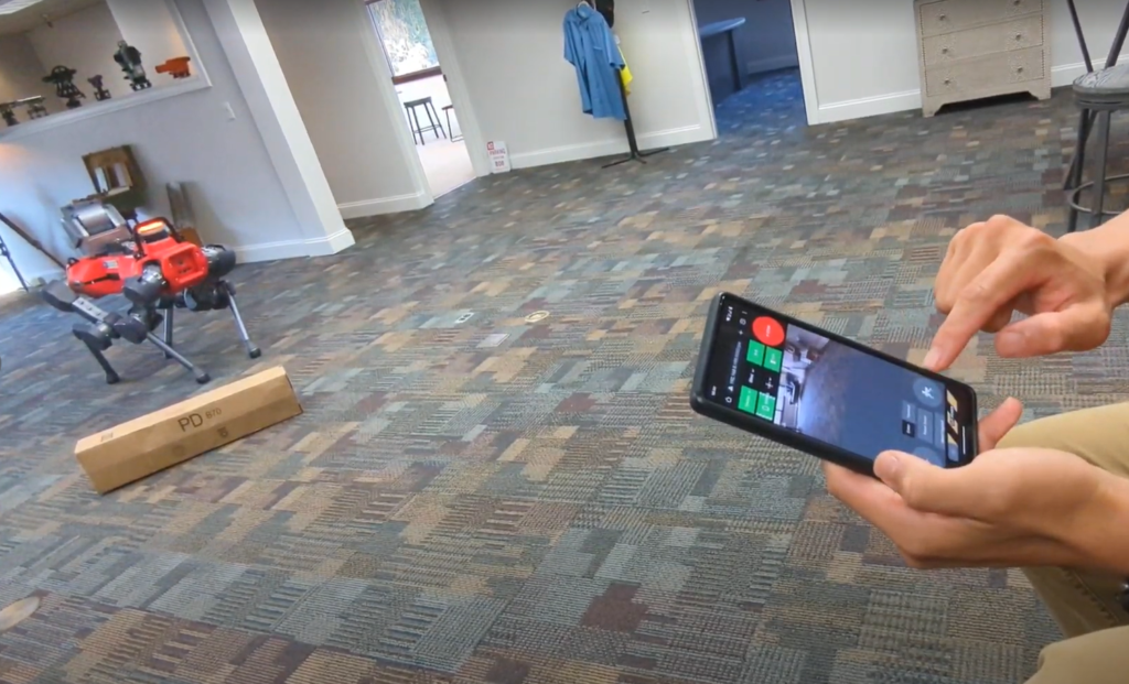
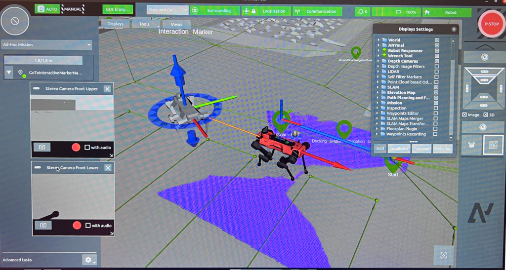
Waypoints are created inside environments. Each waypoint enables UGV positioning, attitude (where it’s facing), and actions. Actions may control where the cameras point, zoom, capture data, engage third-party sensor systems, and more.
A SLAM map of the environment may be used to navigate the UGV through a visual representation of the area/navigable space, or monitored without the SLAM enabled allowing for a clean view of where the UGV is operating.
The ANYmal is capable of manually capturing images while being manually operated (either local or remote), or being instructed to automatically capturing images in a specific location. Video with audio, photographs, thermal images from the included FLIR camera, user-determined zoom, and output from third-party sensors (such as the BLK ARC) may be activated, executed, and downloaded for realtime or post-mission analysis.
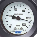
ANYmal is capable of reading virtually any kind of indicator, with user-defined parameters for successful operation or component failure. For example, a user may set an ideal/safe pressure range. When ANYmal senses an anomoly, the anomoly may be reported in real-time to an operator or control station, or the data may be merely collected and responded to post-inspection.
ANYmal is capable of reporting with static images or video (with or without audio), sent to the control station or operator.
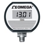
Digital gauges/indicators are sensed/managed in the same way as analog gauges; ideal/appropriate parameters may be set by the operator/controller, and anomolies/out of parameter readings may be real-time reported or delayed until the inspection is complete.
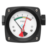
ANYmal also read differential/range gauges, and report when the range is out of standard/user-defined parameters, and report back to the operator or control station. Warnings may be viewed by anyone with a web connection on virtually any platform whether Windows, Android, Mac, or iOS.
Many use cases benefit from mobile scanning from systems such as the Leica BLK ARC system, feeding scan data in real-time to the operator, enabling scans in-motion.
Alternatively, the ANYmal may be configured for static scanning.
The Leica BLK ARC (Autonomous Reality Capture) payload is an option available from KukerRanken, enabling mobile scanning which may be used as a sole data source, or registered with data from other BLK products such as the BLK2Go, BLK2Fly, and so forth.
Combined with Leica Geosystems Cyclone 3DR, the ANYmal with BLK ARC is the ultimate application for any medium or large site inspection, scan, or BIM capture.
Full integration means the owner or operator does not need to research, and eliminates the confusion of what products may or may not be ready for integration with the ANYmal and its systems.
The ANYmal is the world’s only fully integrated, off-the-shelf ready to scan minutes after delivery (and training).
